Of all the excursions on this trip, Vigur Island might be the one I keep thinking back to. It’s a small stop — a tiny island in the middle of Ísafjarðardjúp fjord — but it packs in wildlife, history, and one genuinely remarkable owner into just a few hours.
Getting There
We were picked up right off the dock of the ship and loaded onto a small boat for the crossing. The ride took about 30 minutes, and we couldn’t have asked for a better morning for it — calm water, good light, and views back across the fjord toward Ísafjörður as we pulled away.
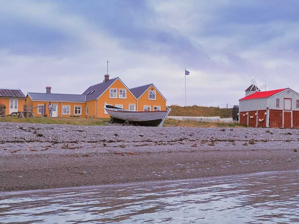
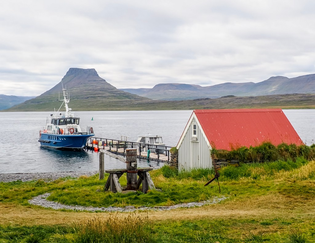
Pulling up to the small dock, the island’s red-roofed boat shed, and windmill came into view — a quiet, working little harbor that felt worlds away from the cruise port we’d just left.
The Island and Its One Family
What makes Vigur so fascinating is who lives there: just one family, and they’re the island’s sole year-round caretakers. The current owner is Felicity Aston, a British polar explorer who, in 2012, became the first woman in the world to ski solo and unassisted across Antarctica — towing her own supplies for 1,744 km over 59 days, using nothing but her own strength the entire way. She first came to Vigur while guiding expedition travelers there, fell in love with the place, and years later bought the island with her husband. Today they’re two of just three permanent residents, running Vigur as a working eider farm and bird sanctuary.
Their main livelihood comes from sustainably harvesting eiderdown — the eider ducks nest right around the family’s home and outbuildings for protection, and in exchange, the down they naturally shed is collected once the ducklings have left the nest. It’s a genuinely symbiotic relationship that’s been part of island life here for generations.
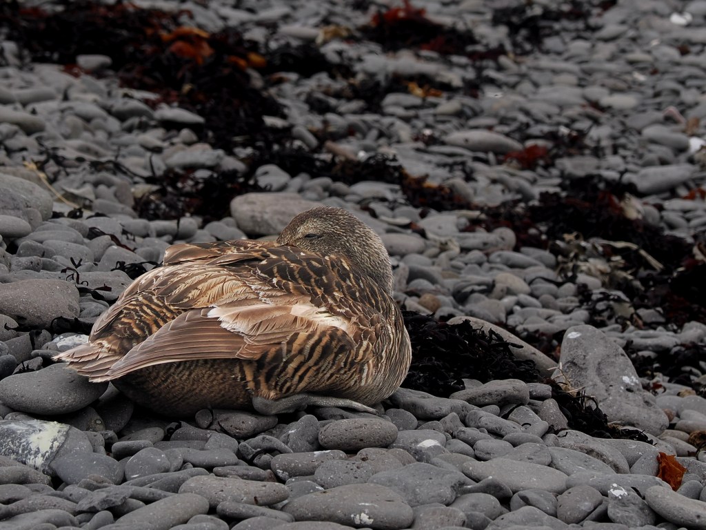
We spotted this eider duck tucked up on the rocky beach, blending almost perfectly into the stones and dried seaweed around her.
The Birds
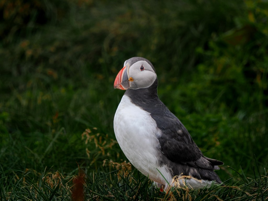
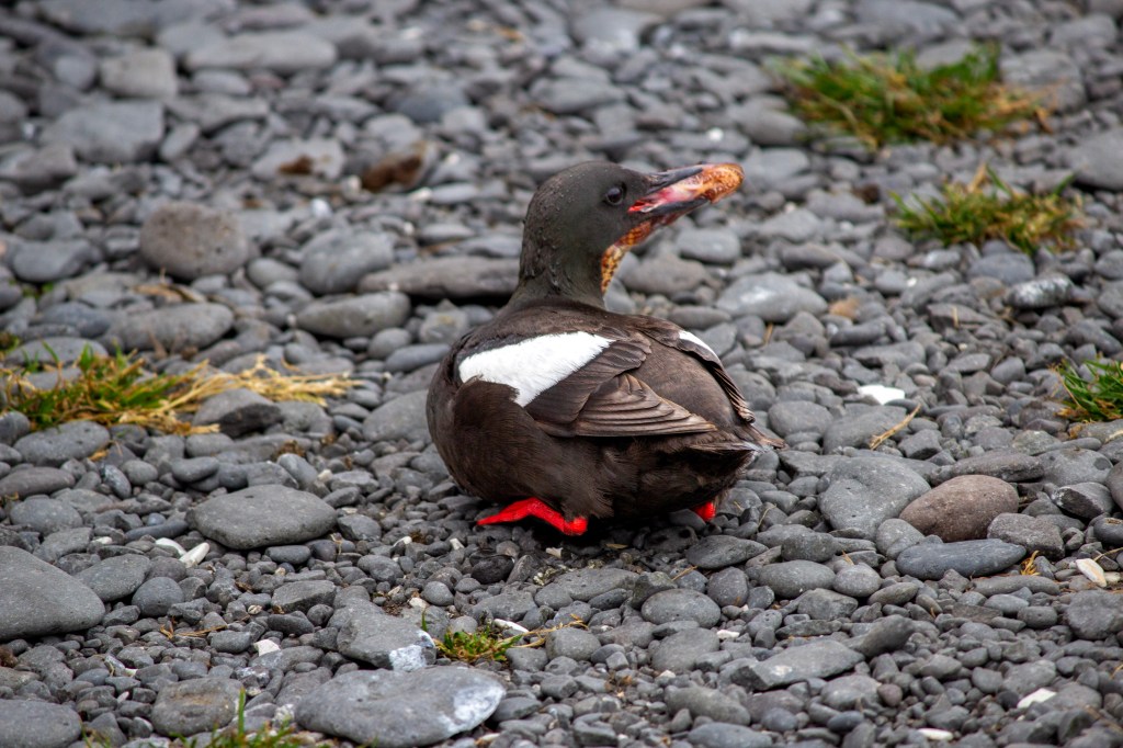
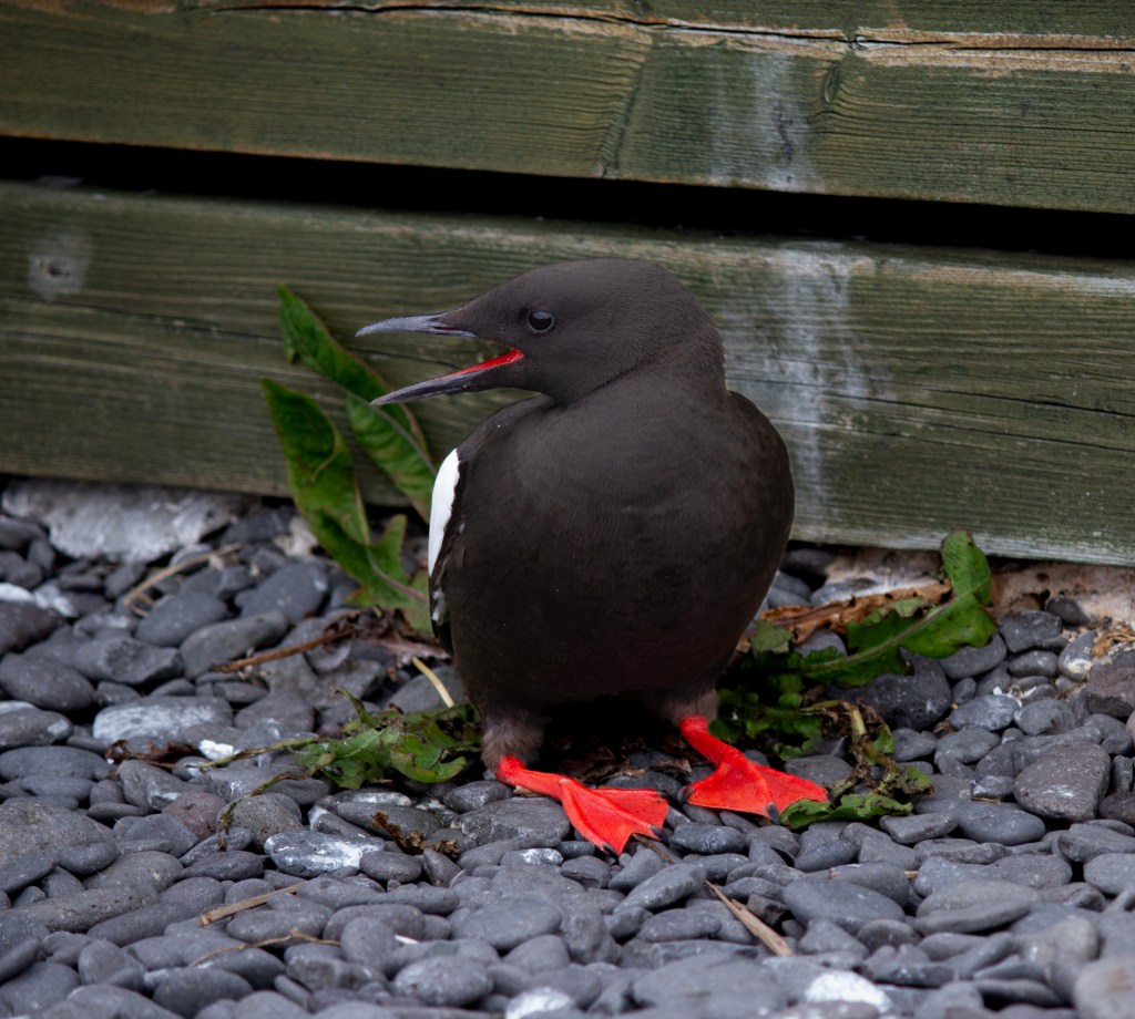
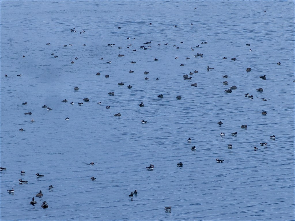
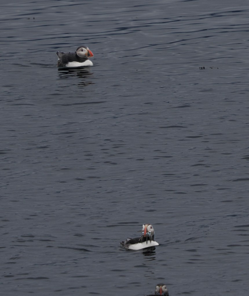
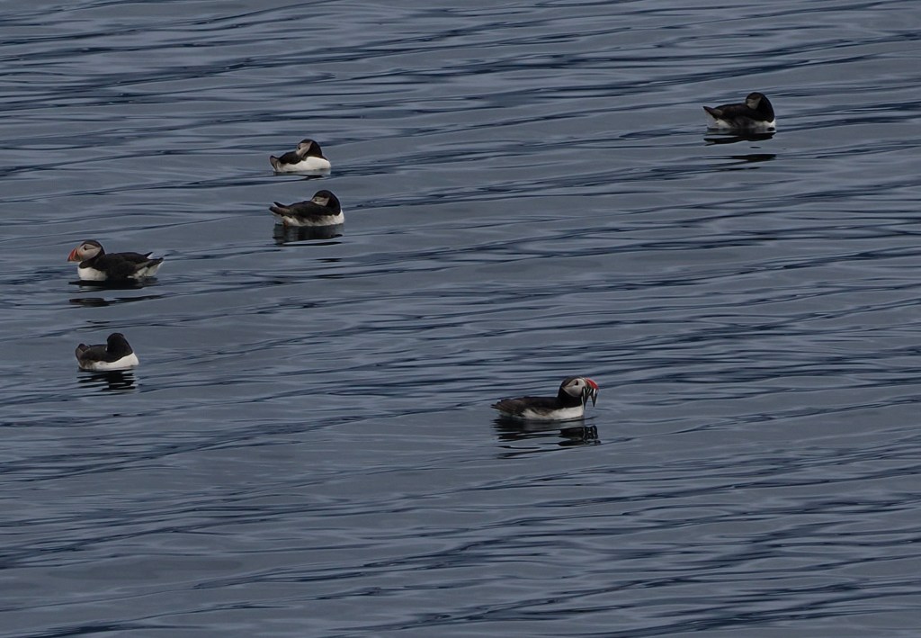
The numbers are hard to wrap your head around: Vigur is home to something like 100,000 puffins, along with thousands of eider ducks and one of Europe’s largest colonies of black guillemot. We saw hundreds of puffins bobbing in the water on the approach, with a handful more flying in low and landing right next to their burrows along the path. Watching them come and go from their nests at close range was worth the trip on its own.
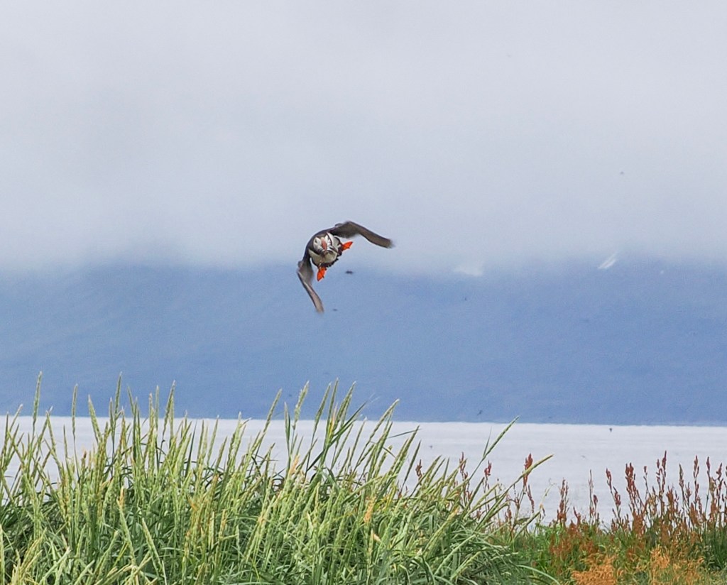
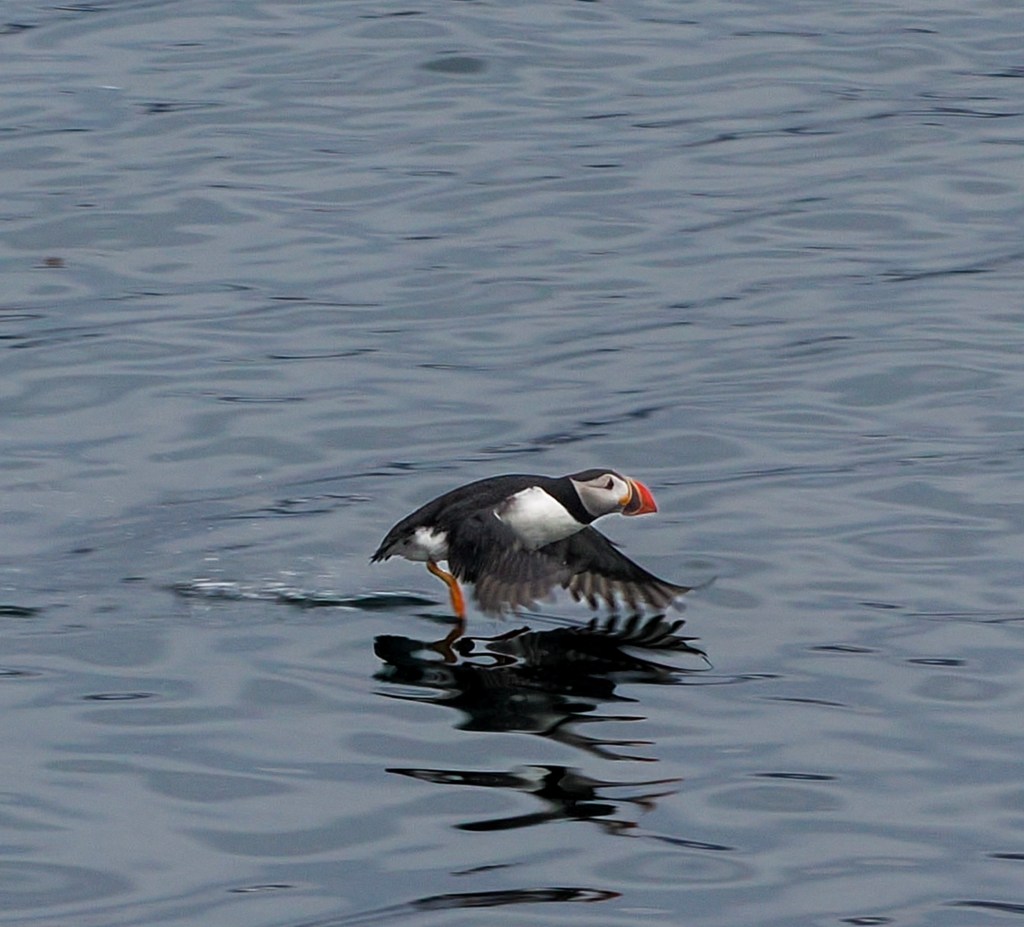
Catching one mid-flight was its own challenge — puffins are fast, low fliers, and this one banked hard just before touching down.
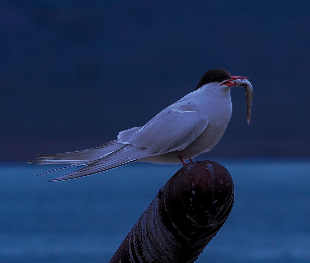
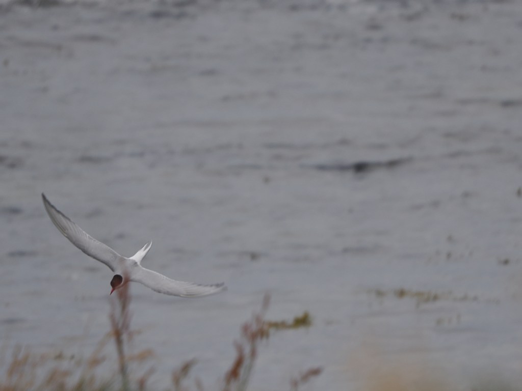
The other bird you can’t ignore is the Arctic tern — and our guide made sure we knew it before we got very far. Arctic terns nest right alongside the walking path, and they are fiercely protective of their chicks. Expect a few dive-bombing runs at your head as you walk through; it’s harmless, if startling, and part of the experience.
The Puffin Path
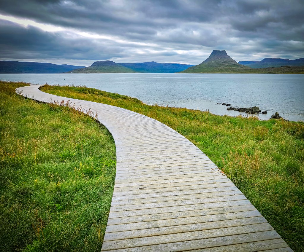
The boardwalk that lets you walk right through the colony without disturbing it is relatively new — it’s called the “Puffin Path,” and it was built in collaboration with National Geographic–Lindblad Expeditions, whose ships regularly stop at Vigur as part of their Iceland itineraries. It’s a genuinely well-designed piece of infrastructure: close enough to the birds to feel immersive, but built specifically to keep foot traffic away from the burrows.
Marriage Cake and the Smallest Post Office in Europe
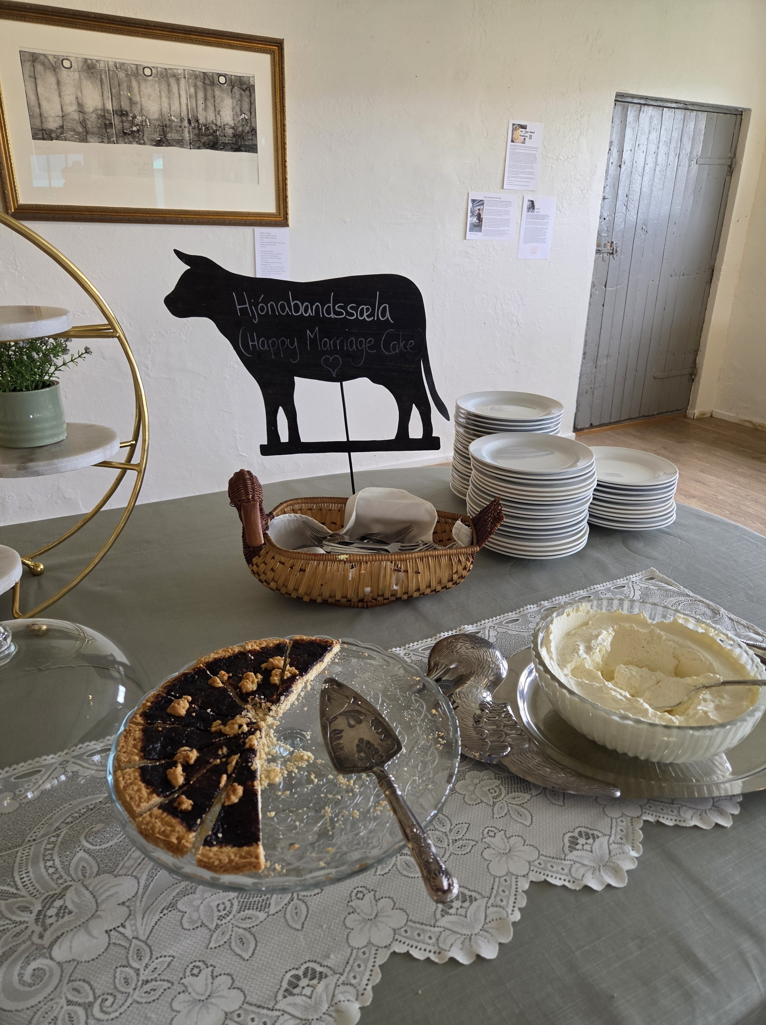
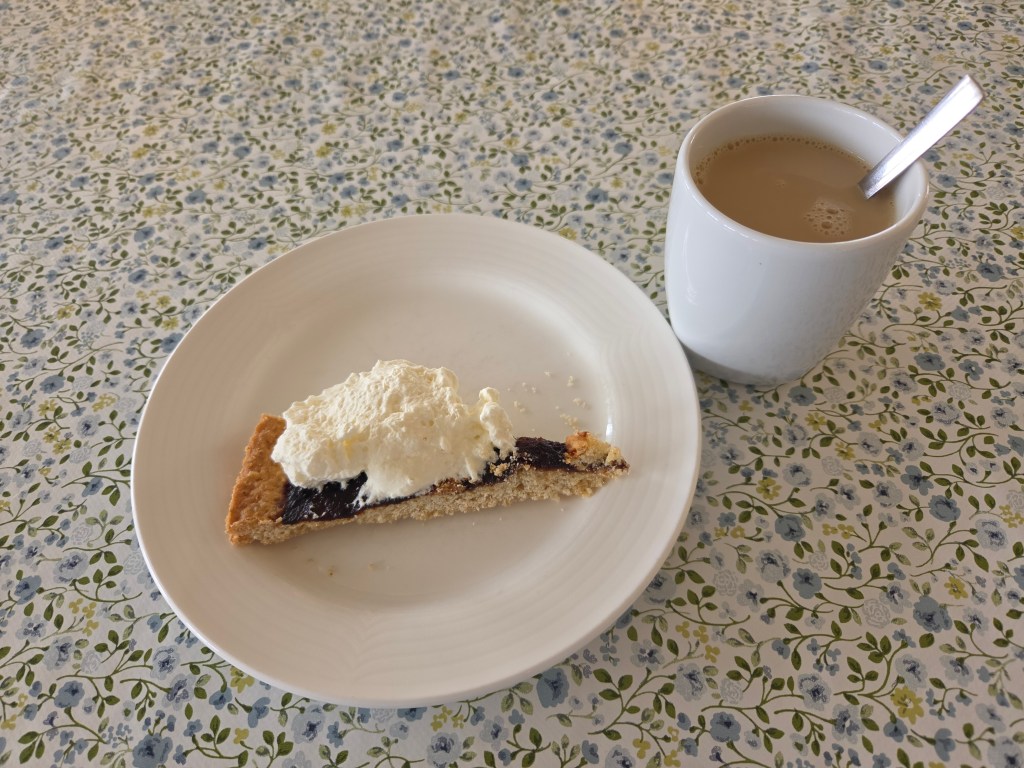
Before heading back to the boat, we stopped for Hjónabandssæla — literally “marital bliss,” a traditional Icelandic rhubarb cake that’s been a Vigur family recipe for generations. It’s a simple, comforting treat after a couple of hours outside in the wind.
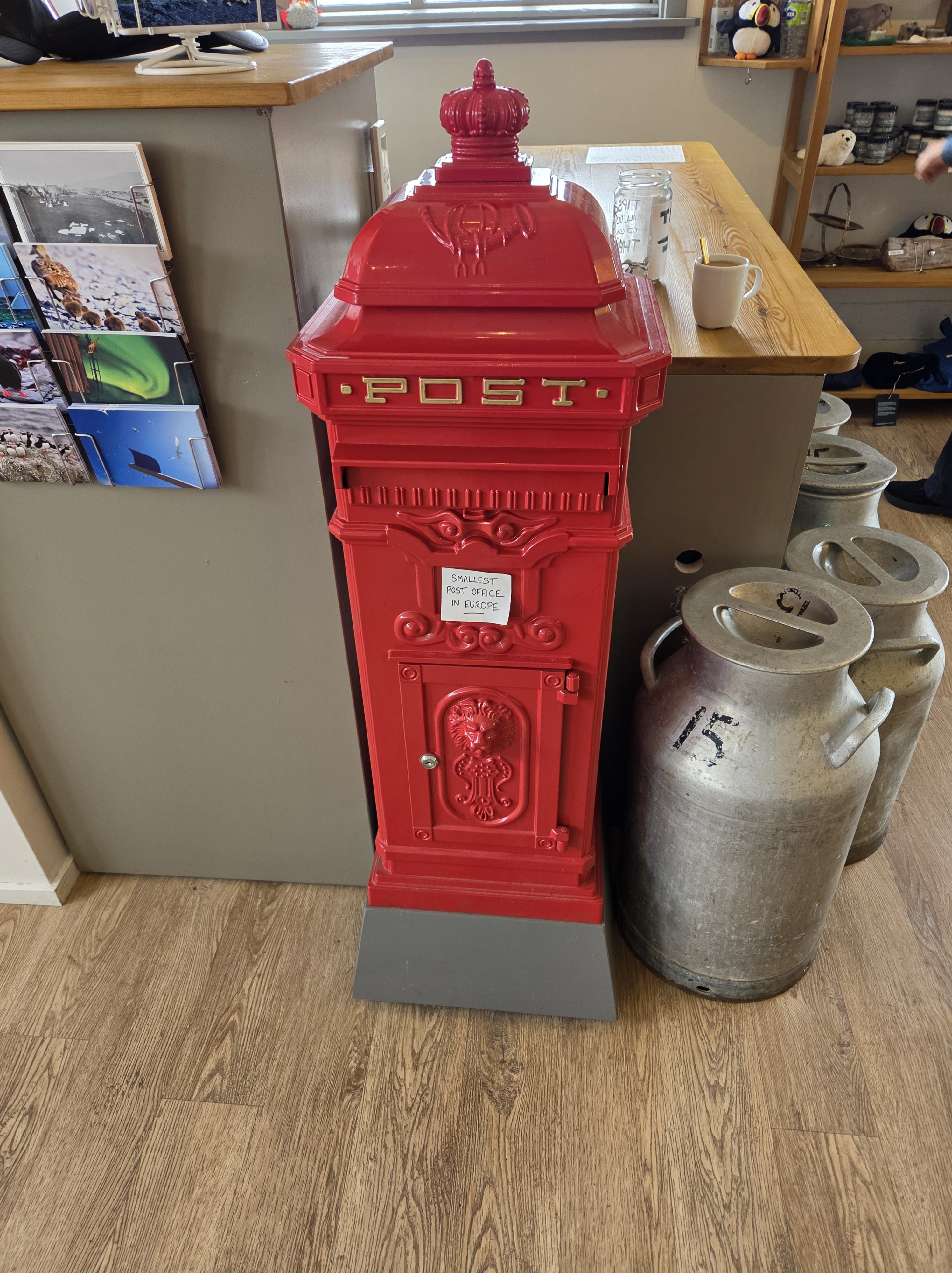
Just as memorable: Vigur’s post office, which claims the title of Europe’s smallest post office. We sent postcards from there, stamped with the island’s own puffin design — mail gets picked up “every now and then” rather than on any fixed schedule, so don’t expect it to beat you home.
Worth Its Own Trip
Between the boat ride, the puffins, the eider ducks, the Arctic terns keeping us on our toes, the cake, and Felicity’s story, Vigur ended up being one of the most memorable stops of the whole cruise — a tiny island that somehow has more going on than places many times its size.
Read next: our full day in Ísafjörður, including the walk through Old Town and the decision that sent us to Vigur instead of Dynjandi Waterfall.
Our final day on the cruise brought us to Ísafjörður — another gorgeous day of weather and, once again, a town that felt like the quintessential slice of Iceland.
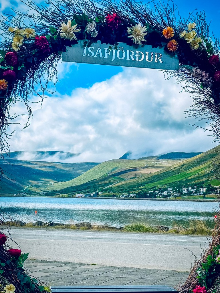
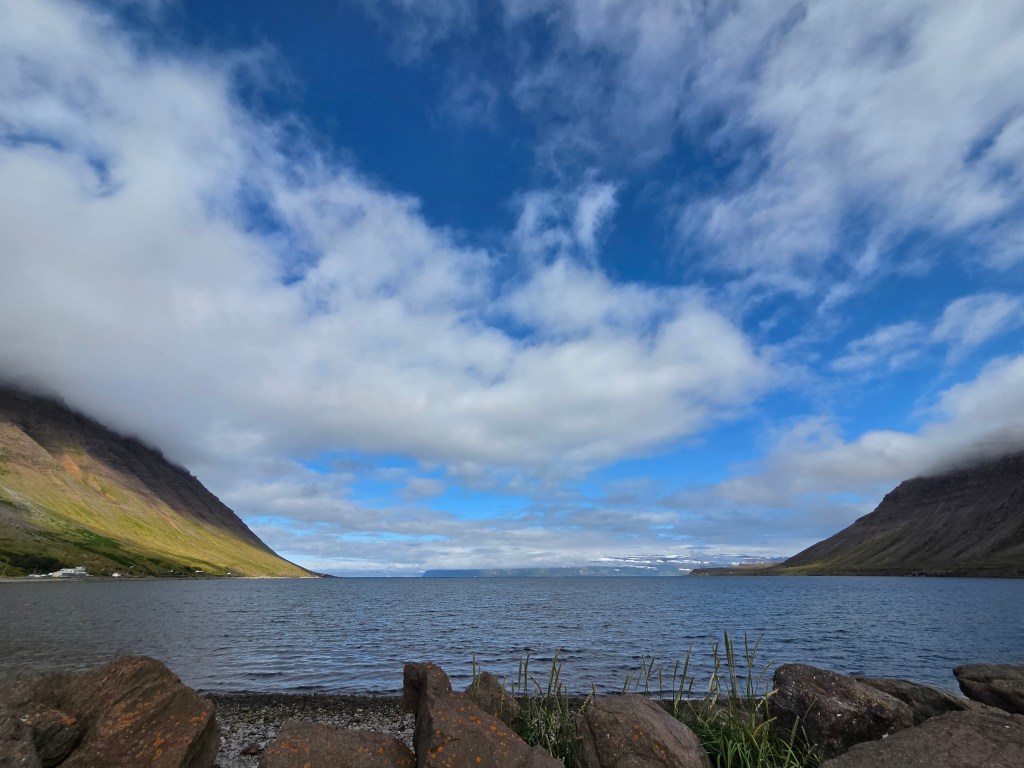
Right near the harbor, a flower-and-branch arch spelling out “ISAFJÖRÐUR” frames the view straight down the fjord toward the mountains — a popular photo stop for arriving passengers. I couldn’t track down a specific artist or designer credited for this one; it looks like a seasonal installation put up for the tourist season rather than a permanent public artwork (unlike the town’s well-known Whalebone Arch over in Jónsgarður Park, made from the jawbones of a blue whale). Either way, it’s a nice frame for that first look at the fjord and the mountains rising straight out of the water.
About Ísafjörður
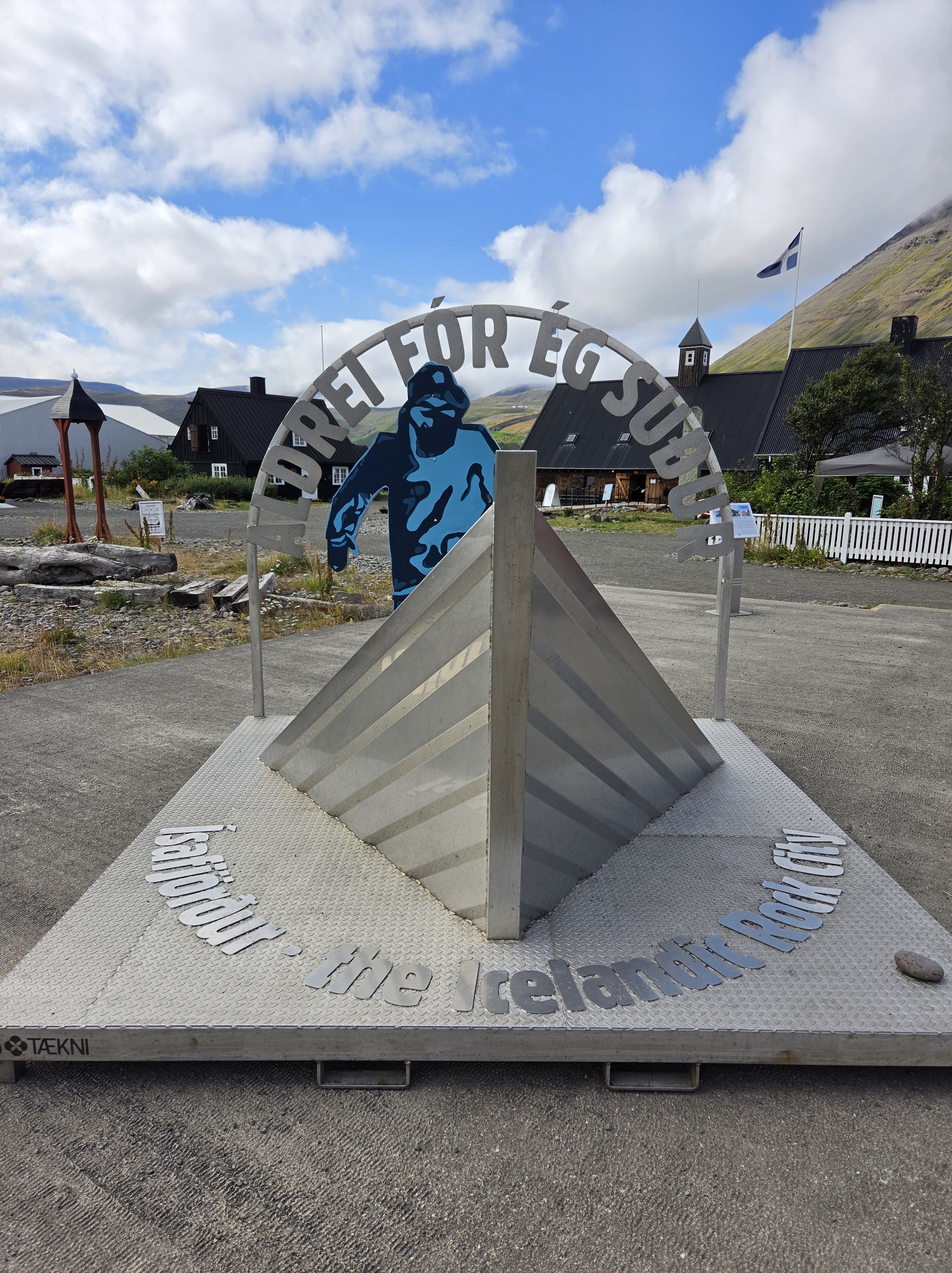
Nestled within the Skutulsfjörður fjord, Ísafjörður is the largest settlement in the Westfjords, with a population of just 2,744. Each year, the town punches well above its weight, drawing thousands of visitors for the Aldrei fór ég suður music festival, founded by Icelandic musician Mugison and his father.
The area has deep roots. According to Landnámabók (the Book of Settlements), Helgi Hrólfsson first settled Skutulsfjörður in the 9th century, with merchants arriving in 1569. Ísafjörður became the principal trading port in the Westfjords during the peak years of the Danish trade monopoly—back when the community was still known as Eyrarhreppur.
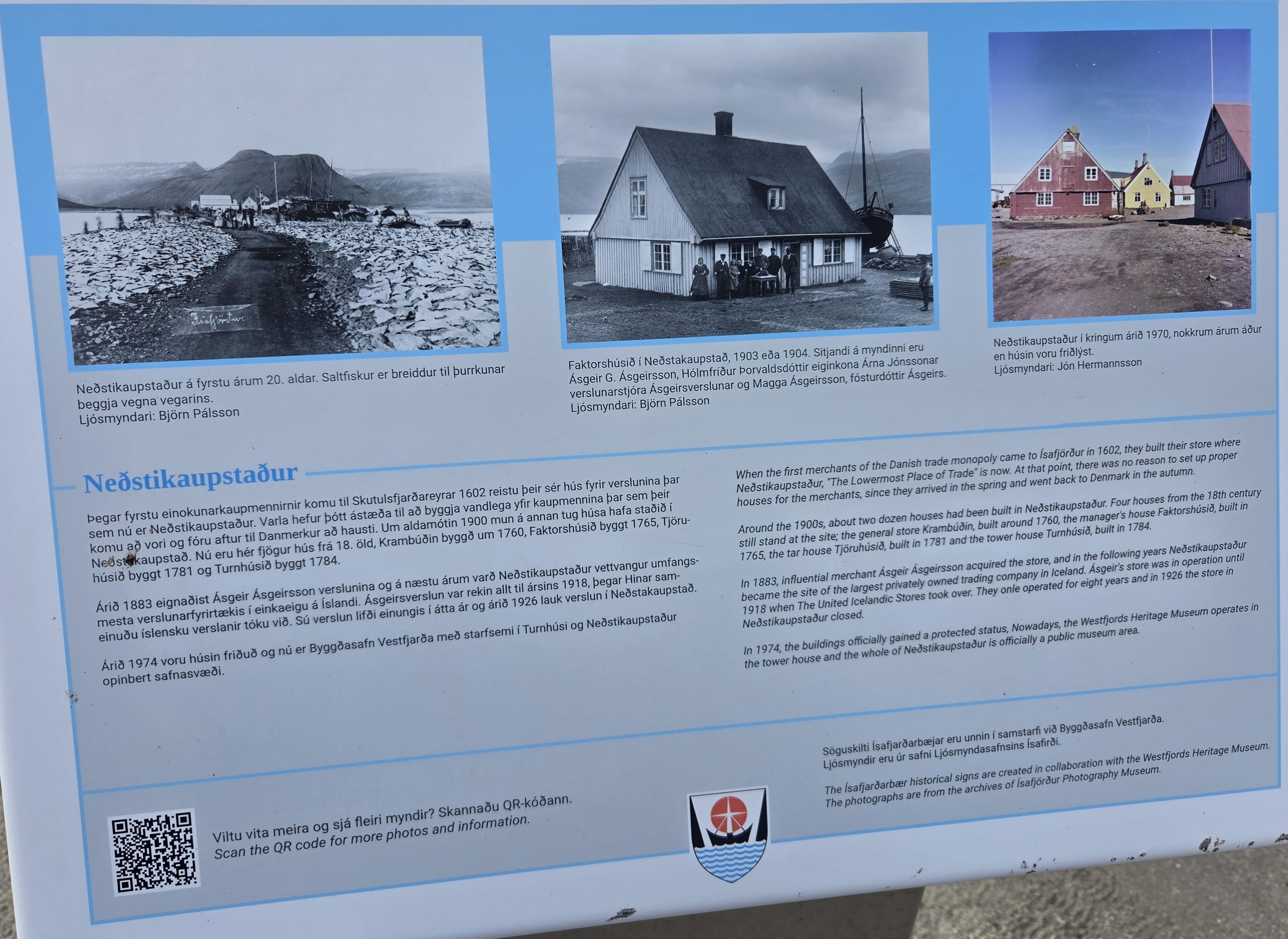
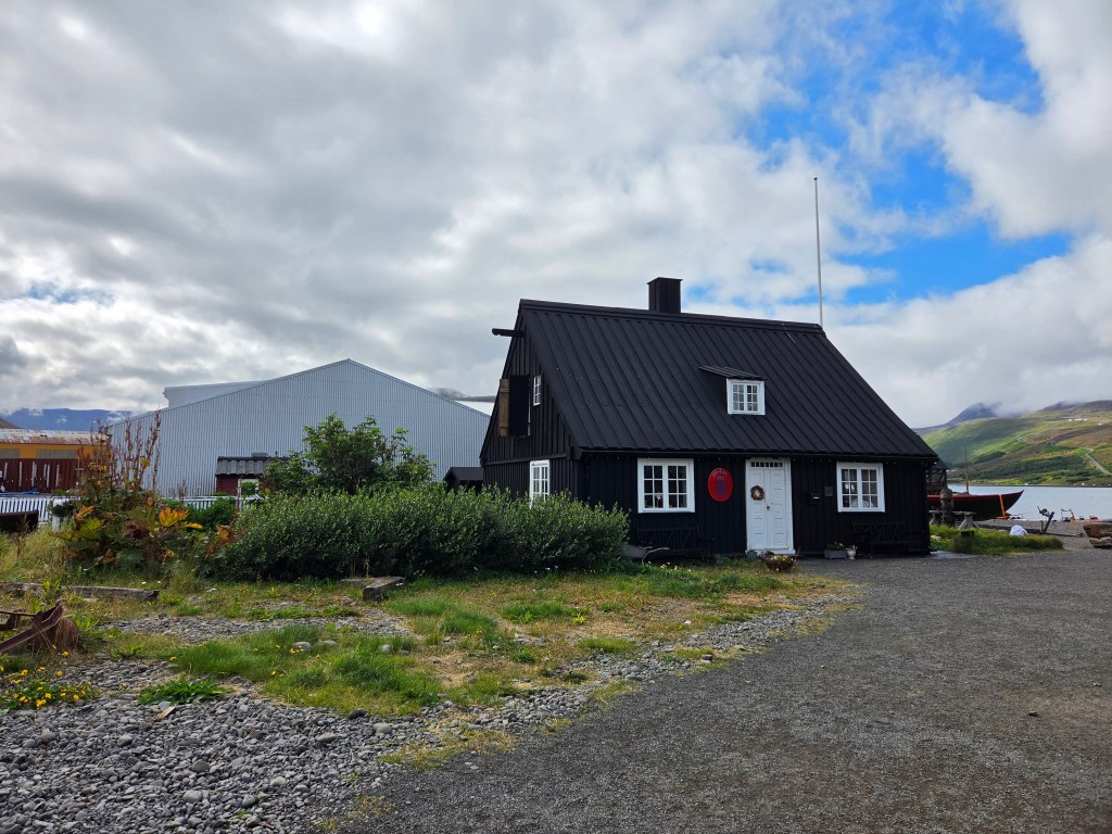
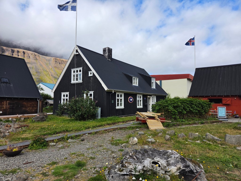
Right by the harbor sits Neðstikaupstaður, one of the oldest clusters of timber houses in Iceland. Most of the buildings are protected and date from 1757–1784, with Krambúðin standing as the oldest of the group. One of these historic houses, Turnhúsið, now houses the Westfjords Heritage Museum, offering a window into the region’s maritime and cultural history.
The town has also produced its share of notable Icelanders, including musician Helgi Björnsson, former president Ólafur Ragnar Grímsson, and Bishop of Iceland Agnes M. Sigurðardóttir.
Puffins Over Waterfalls: Choosing Vigur Island
Our original plan for the day was a 3.5-hour sightseeing tour to Dynjandi Waterfall — the dramatic “bridal veil” of the Westfjords. But a couple of nights before, while browsing Viator, I stumbled on a puffin tour to Vigur Island instead, and that changed our plans.
We’d missed out on seeing puffins back at Heimaey, so with a tight schedule and only one excursion to choose, Vigur Island won out. It’s a 3-hour round trip, home to around 100,000 puffins, Iceland’s only windmill, and Europe’s smallest post office — and it deserves its own post entirely.
If you have more time in port than we did, you could realistically do both Dynjandi Waterfall and Vigur Island in the same day. For us, choosing one over the other worked out well, since the 3-hour tour still left plenty of time to walk around Ísafjörður afterward.
Walking Around Ísafjörður
After we got back from the puffin tour, we spent the rest of our time exploring the town on foot — easily done in an hour or two, and a nice, relaxed way to close out the trip.
Highlights worth looking out for:
Neðstikaupstaður (the Old Town): The historic harbor district, lined with colorful timber trading houses and restored warehouses dating back to the 18th century. It’s compact, walkable, and full of small details — carved doorframes, old signage, and weathered wood — that tell the story of the town’s trading past.
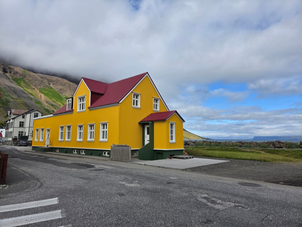
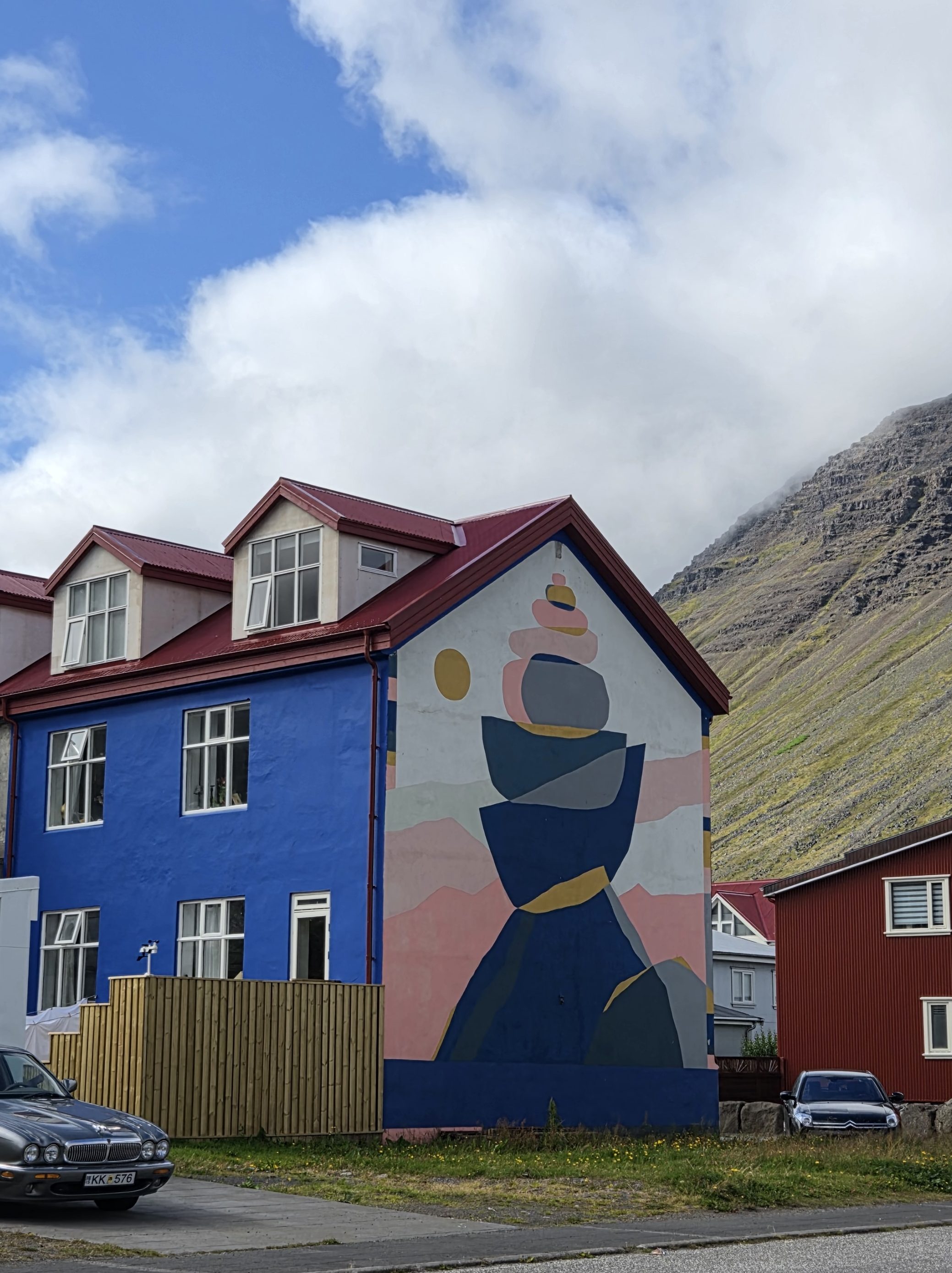
Colorful houses: Beyond Neðstikaupstaður, the brightly painted homes throughout town make for some of the most photogenic streets in the Westfjords.
Bookstores: Ísafjörður has a genuine literary streak for such a small town — worth popping into one of the local bookshops for a browse, even if just to see what an Icelandic small-town bookstore looks like.
The Westfjords Heritage Museum: Housed in Turnhúsið, one of the oldest buildings in the cluster, with exhibits on the region’s fishing and maritime heritage.
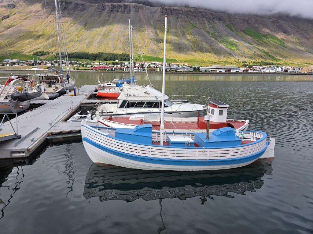
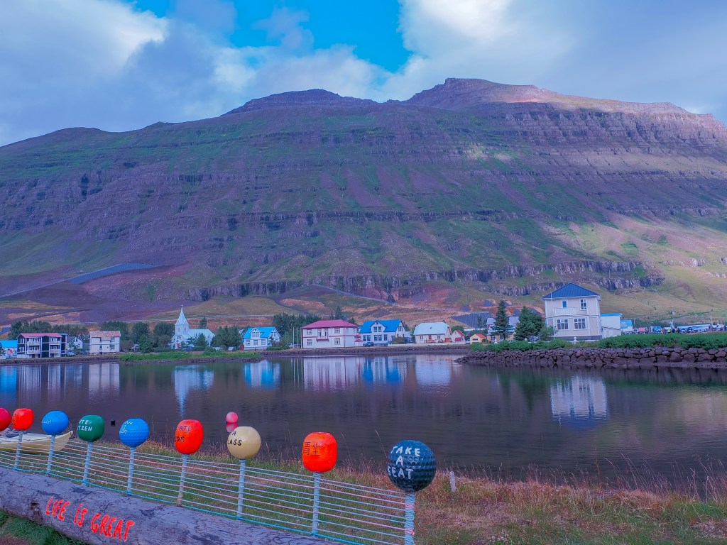
The harbor: A good spot to see fishing boats framed against the fjord and the steep, flat-topped mountains that rise straight out of the water.
If You Have More Time: Dynjandi Waterfall or the Troll’s Throne Hike
Since we only had one excursion slot to fill, we went with Vigur Island — but Ísafjörður has at least two other classic options worth considering if your schedule allows. The first is the original plan we passed on: Dynjandi Waterfall, often called the most beautiful waterfall in the Westfjords. It’s a roughly 3.5–4 hour round-trip excursion from town, tumbling down a 100-meter rocky scarp in a series of tiered, fan-shaped cascades — the kind of “bridal veil” waterfall that looks almost too perfect to be real.
The second option is much closer to town and takes far less time: the hike up to Naustahvilft, better known as the Troll’s Throne (or Troll’s Seat). It’s a short but steep climb — about 170–190 meters of elevation gain, doable in well under an hour round trip — up to a dramatic, chair-shaped hollow carved into the mountainside above the fjord. Local legend says a giant troll, rushing home before sunrise, sat down here to rest her aching feet, and her weight left the seat-shaped imprint in the rock. Geologically, it’s actually a glacially carved hanging valley, but the folklore version is more fun to tell. From the seat itself, you get a sweeping panorama over Ísafjörður, the harbor, and the fjord — reportedly one of the best views in town, and a nice option if you want a quick hike rather than a half-day boat trip or drive. Next time, I’d love to squeeze in the Troll’s Throne on top of everything else — it looks like the kind of short, dramatic hike that’s easy to regret skipping
It was a slow, easy way to end the cruise — puffins in the morning, colorful old timber streets in the afternoon, and one last look at the Westfjords before heading back to the ship.
If you’ve ever wanted to walk through what looks like the ruins of a giant’s fortress, Dimmuborgir will feel like it was built for exactly that daydream. This otherworldly field of jagged black lava towers near Lake Mývatn is one of the strangest, most photogenic landscapes in Iceland—and it comes with a story as dramatic as the rock formations themselves.
What Is Dimmuborgir?
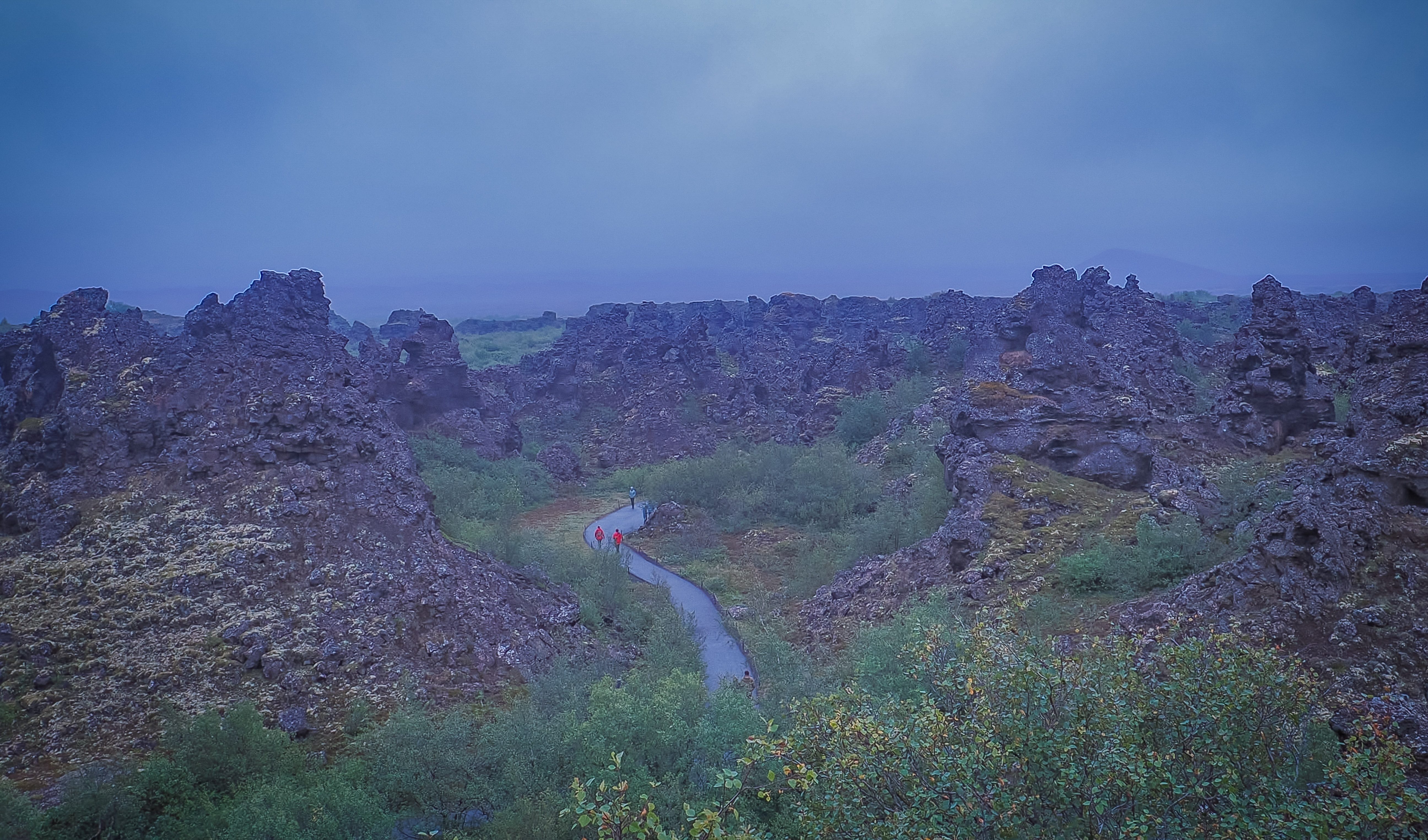
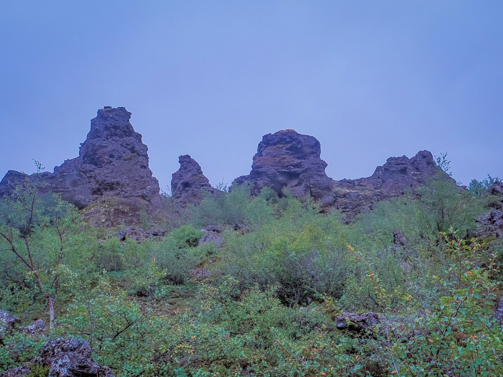
Dimmuborgir means “Dark Castles” or “Dark Fortress” in Icelandic, and one look at the place tells you why. Instead of the smooth, rolling lava fields you’ll find elsewhere in the country, Dimmuborgir is a maze of hollow pillars, twisted arches, and jagged spires that rise up to 20 meters (65 feet) into the sky — looking far more like the crumbling battlements of an ancient castle than a natural rock formation.
It’s no surprise the site has worked its way into Icelandic folklore. Dimmuborgir is said to be the home of Grýla, the child-eating troll of Icelandic Christmas tradition, along with her husband Leppalúði and their mischievous sons, the thirteen Yule Lads. Rather than a jolly Santa Claus figure, Icelandic kids grow up with these unsettling characters supposedly lurking in the lava just outside town — which makes wandering through Dimmuborgir’s twisted pillars and hidden caves feel a little eerier once you know the backstory.
Fantasy fans will recognize the landscape from another world entirely: Dimmuborgir served as the filming location for Mance Rayder’s Wildling army camp in Game of Thrones Season 3, and the same lava field also doubled as the site of Samwell Tarly and Lord Commander Mormont’s White Walker attack. The scenes were shot in deep winter snow, so if you want the full “Beyond the Wall” effect, a winter visit gets you close to what the cameras captured. It’s a short drive from Grjótagjá, the small lava cave used as Jon Snow and Ygritte’s cave scene, so the two make an easy pairing for anyone chasing GoT filming spots around Mývatn.
How Dimmuborgir Was Formed
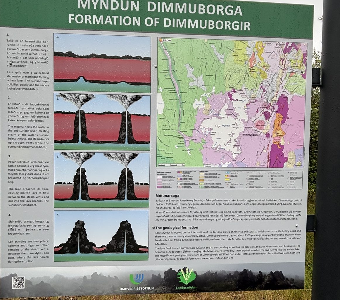
The formations at Dimmuborgir aren’t the result of erosion or wind, like most dramatic rock landscapes — they were created almost instantly, geologically speaking, around 2,300 years ago.
Here’s what happened: a massive lava flow spread across the area and rolled directly over a small lake or wetland. As the molten lava crept over the water, the water beneath it flash-boiled into steam. That trapped steam pushed upward through the lava, forcing its way out through narrow channels — similar to how straws poke through wet cement before it sets. As the steam escaped, it left behind hollow chimneys and pillars of hardened lava rising up out of the flow.
When the main body of lava eventually drained away or cooled and partially collapsed, it exposed this strange skeleton of towers, arches, and caves that had formed around the escaping steam. The result is the twisted, castle-like landscape you can walk through today — a rare, dramatic record of steam and lava colliding in real time.
What Not to Miss When Visiting
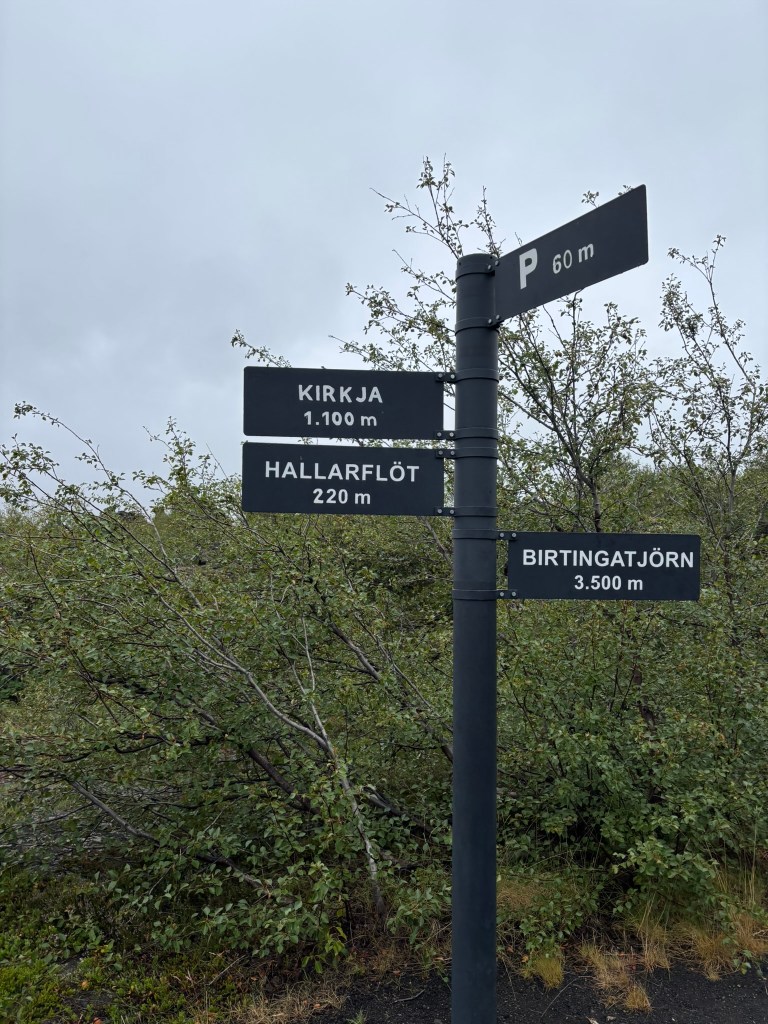
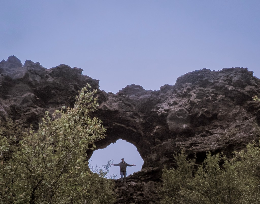
Kirkjan (The Church) — the single most famous formation in Dimmuborgir: a massive natural lava arch large enough to walk straight through, shaped uncannily like a Gothic church doorway. It is about 1 Km from the starting point and we didn’t make it all the way to this point
The marked trail loops — there’s a short ~20-minute loop for a quick visit, and a longer ~1-hour loop that winds deeper into the maze of towers. If you have the time, take the longer one — it’s where the landscape gets genuinely eerie and beautiful.
Hallarflöt — a much shorter detour, only about 220 m off the main path
The birch woodland pockets — small patches of stunted, wind-bent birch trees growing straight out of the black lava, an unusual and striking contrast worth slowing down for
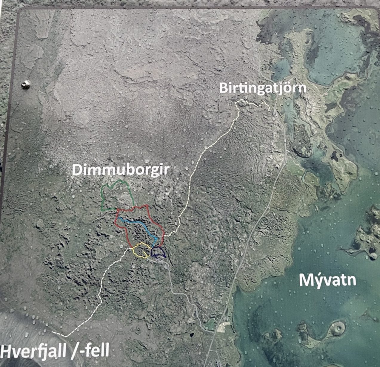
Different hiking paths
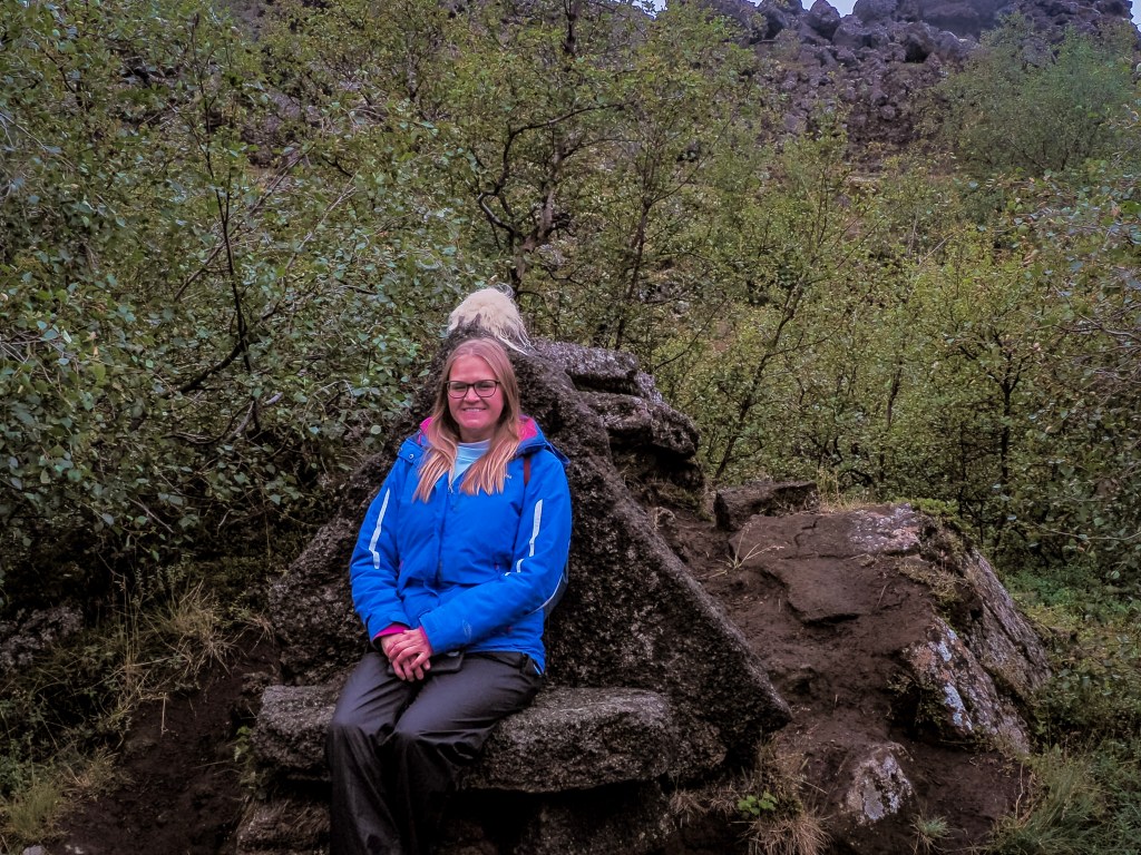
Hallarflöt is one of the smaller, quieter clearings within the lava field — a natural meadow tucked among the rock formations, ringed by birch scrub. It’s an easy, short detour if you’re already on the main loop, and one of the more peaceful spots to stop for a photo away from the busier arches. Look out for oddly shaped rock “seats” and ledges worn smooth enough to perch on — it’s a favorite low-key photo spot for visitors making their way through the maze.
My friend Kat at Hallarflöt
If you’re planning your route, the signposts make it easy to string together a loop hitting Hallarflöt, Kirkja, and back to the car park in under an hour, or extend it out to Birtingatjörn if you want more time among the lava towers.
Golden hour light — visit early morning or evening if you can. Low, angled sunlight throws long shadows between the pillars and makes the whole site feel even more dramatic for photos.
These are some of my favorite shots from the area. The restrooms and gift shop give you a panoramic view of the valley.
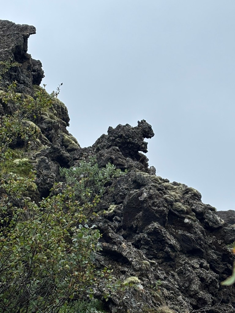
Rock formation that looks like a squirrel
Dimmuborgir pairs naturally with Hverfjall crater, just 5 km away, so most visitors combine the two into a single stop on their way around Mývatn or the wider Diamond Circle route.
Parking Fee at Dimmuborgir
Unlike some of the free stops around Mývatn, Dimmuborgir now charges a parking fee of 1,000 ISK per car at the trailhead. There’s no separate entrance fee to walk the trails — the parking fee is the only cost to visit. Look for a payment sign, QR code, or attendant at the car park, and pay before you head off on the trail; paying after the fact typically comes with a penalty.
Quick tip: parking fees have become increasingly common across Iceland’s most popular natural sites in recent years, so it’s a good habit to assume payment is required and check for signage at any managed car park before walking away.
There’s a stretch of Iceland’s Ring Road where the vegetation simply stops. One minute you’re driving past green wetlands and grazing sheep, the next you’re pulling into a barren, steaming, sulfur-stained moonscape where the ground hisses and bubbles like it’s alive. Locals call it “Hell’s Kitchen.” The rest of us call it Hverir — and it might be the single strangest place you’ll stand on your entire Iceland trip.
Hverir (Námaskarð)
What Is Hverir (Námaskarð)?
Hverir sits at the foot of Mt. Námafjall in North Iceland, just a few kilometers east of Lake Mývatn on Route 1. You’ll see it referred to interchangeably as Hverir, Námaskarð, Námafjall Hverir, or Hverarönd — they’re all pointing at the same high-temperature geothermal field, one of the most intense and accessible in the country.
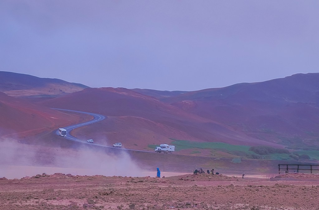
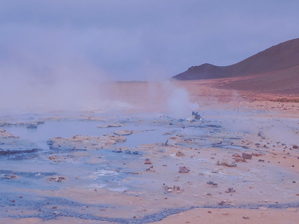
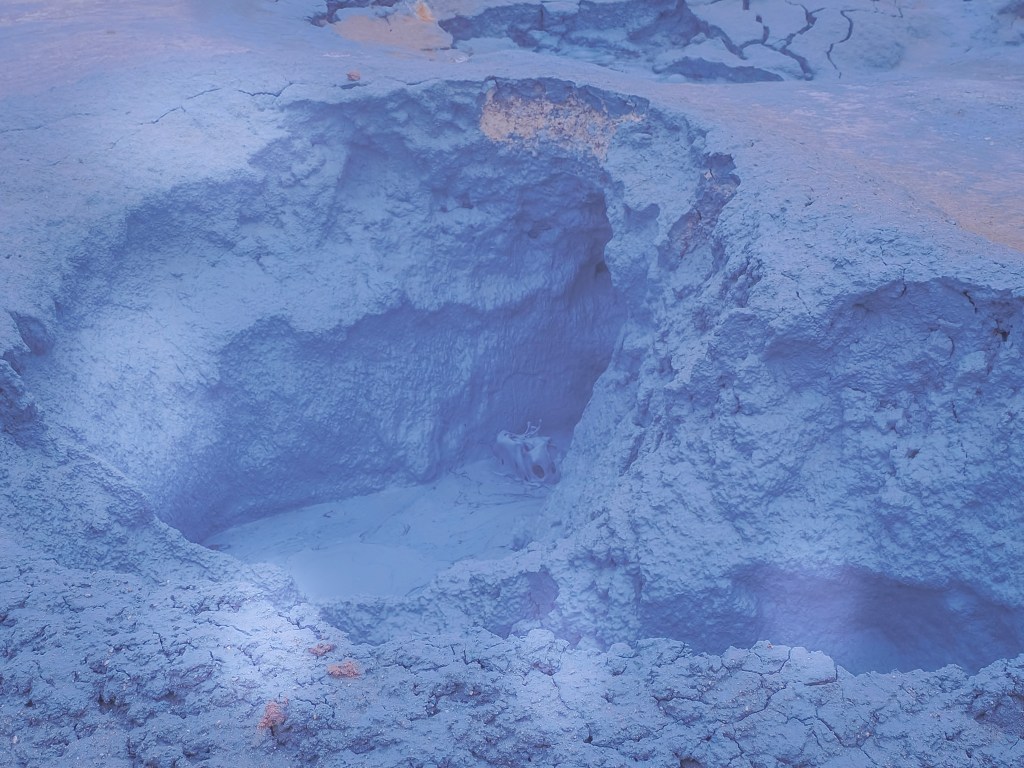
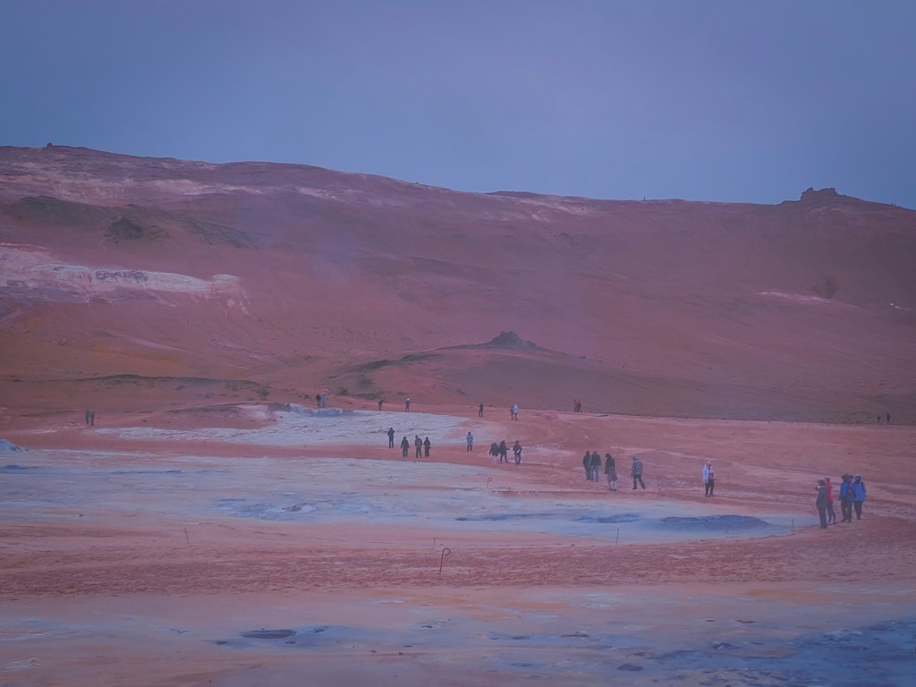
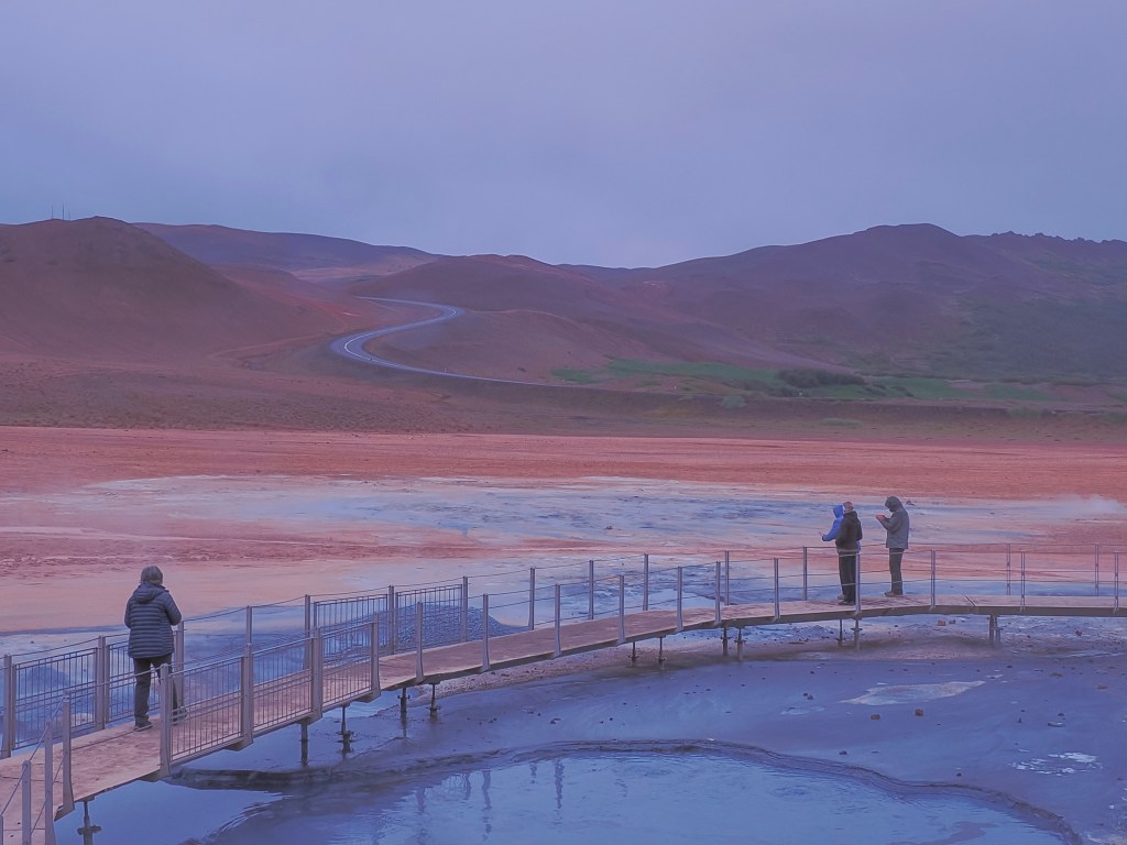
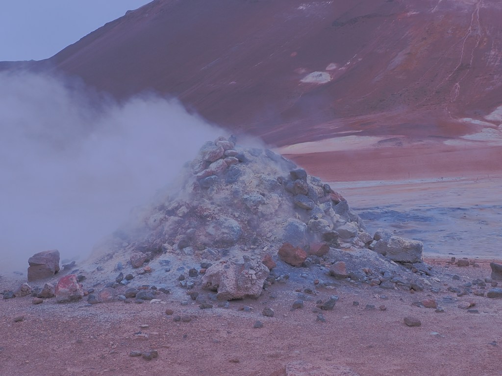
No hiking is required to feel the full effect. Pull off the Ring Road, step out of the car, and you’re immediately surrounded by hissing steam vents (fumaroles), bubbling grey mud pots, and ground streaked in shades of yellow, orange, red, and white from mineral deposits. The Icelandic nickname for the area, eldhús djöfulsins — “the Devil’s Kitchen” — is not an exaggeration once you’re standing in it. Steam drifts across the barren ground right where Hverir meets the Ring Road — you’ll spot it long before you arrive.
The Sulfur That Armed Medieval Europe
Behind the surreal colors is a genuinely surprising piece of history: Hverir wasn’t just a geological curiosity to the people who lived near it. For centuries, it was an industrial site.
Sulfur has probably been extracted from the Námafjall area since as early as the thirteenth century. Back then, sulfur was one of the most valuable commodities you could get your hands on, because it was a key ingredient in gunpowder. At the height of demand, a large share of the sulfur used in gunpowder production across medieval and early modern Europe came directly from mines around Námaskarð — meaning this quiet, remote patch of North Iceland was, for a stretch of history, genuinely strategically important to armies and empires that most Icelanders would never see.
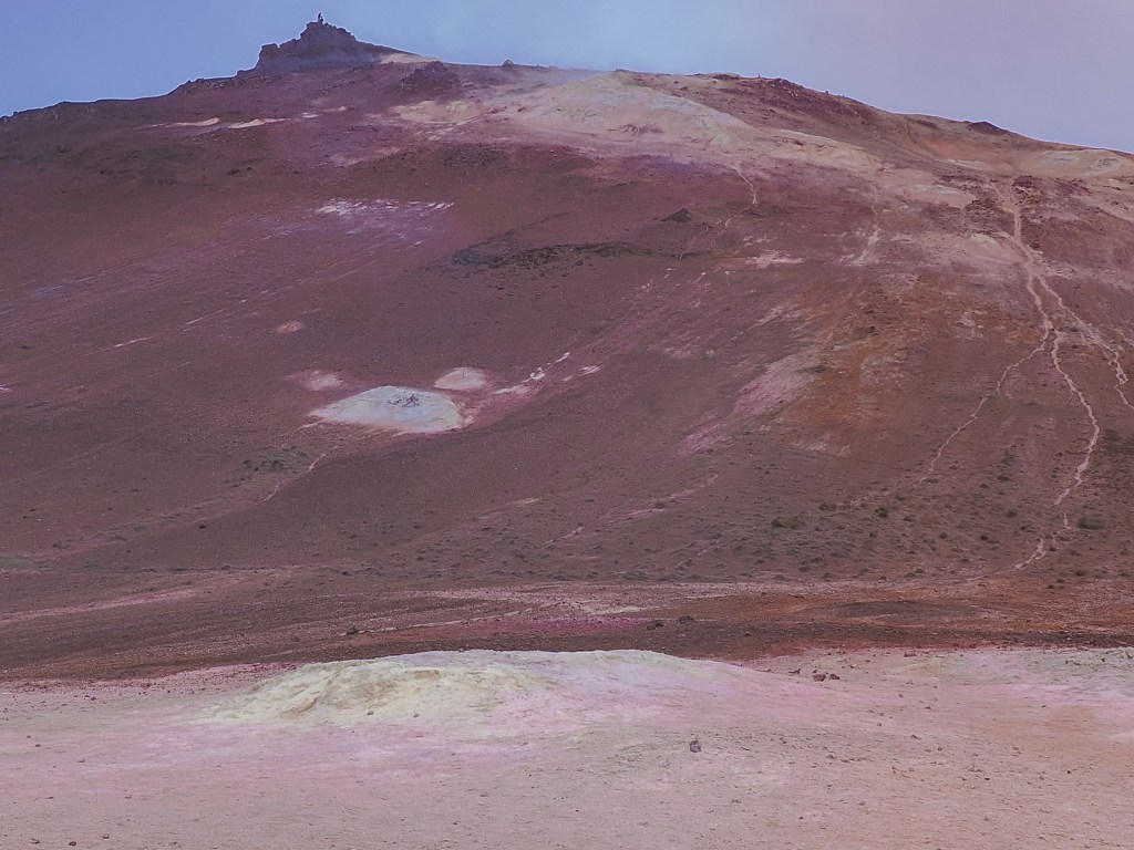
The slopes of Mt. Námafjall still show the mineral bands that once made this a working sulfur mine — reds and oranges from iron oxide, pale patches where sulfur bleaches the ground.
The trade eventually caught the attention of foreign powers: by the sixteenth century, the local sulfur deposits had come under the control of the Danish Crown, which controlled Iceland at the time. Miners worked the deposits in brutal conditions — unstable, superheated ground, choking sulfurous gas, and difficult terrain that made transporting the material out of North Iceland a serious logistical challenge in its own right. Extraction continued with varying intensity into the nineteenth century, with a brief attempt to revive mining around 1940.
Eventually, gunpowder stopped being the point. As Iceland’s relationship with its geothermal landscape shifted from extraction to energy, places like Hverir became valuable for an entirely different reason: geothermal power now heats the vast majority of Icelandic homes, and the same volcanic forces that once produced sulfur for war are now a cornerstone of the country’s renewable energy.
The name itself still carries the memory: Námaskarð translates roughly to “Mine Pass” — a nod to a few hundred years of people working in one of the most hostile environments in Iceland, long before anyone came here to take photos.
What to See at Hverir
The fumaroles — steam vents where volcanic gas escapes through cracks in the earth, some loud enough to hear before you spot them. On calm days the steam rises straight up in tall columns; on windy days it sweeps sideways across the whole field.
The mud pots (solfataras) — thick, grey, boiling mud that pops and bubbles constantly. Mesmerizing to watch, and one of the best photo subjects in the area.
The mineral-stained ground — bright yellow elemental sulfur crusts around the most active vents, with rust-orange and white patches from iron oxide and silica deposits nearby.
Mt. Námafjall — the orange-toned rhyolite mountain towering over the field. If you have extra time, a hike up gives you a sweeping view down over the entire geothermal area and Lake Mývatn beyond it.
The two 1950s boreholes — a pair of especially striking fumaroles drilled during a mid-century sulfur exploration effort, among 16 wells sunk in the area at the time.
Recommended time: 30–60 minutes for the main field on the marked walkways; 2–3 hours if you add the Námafjall hike.
Safety note: stick to the marked paths. The crust around fumaroles and mud pots can look solid while hiding scalding mud or steam just beneath the surface, and severe burns are a real risk if you wander off-trail. Try to stay upwind of the strongest vents too — the sulfurous gas is unpleasant at best and irritating to breathe at worst.
Parking Fee at Hverir
Hverir charges 1,200 ISK for parking, payable through the EasyPark app. There’s no separate entrance fee to walk the geothermal field itself — the parking charge is the only cost of a visit. As with most managed car parks in Iceland these days, pay before you set off on foot rather than after; retroactive payment usually comes with a penalty.
Hverir sits right on the Diamond Circle route and pairs easily with nearby Krafla volcano and the Mývatn Nature Baths, making it a natural stop whether you’re doing a full day loop or just passing through on the Ring Road.
Our ship docked at Seyðisfjörður, and with a full day ashore, we set out inland to chase two things Iceland does better than almost anywhere else: waterfalls and basalt columns. The route took us past Gufufoss and Rjúkandafoss before finishing at the main event — Stuðlagil Canyon. In my opinion, Stuðlagil Canyon is a must-visit in Iceland.
First Stop: Gufufoss
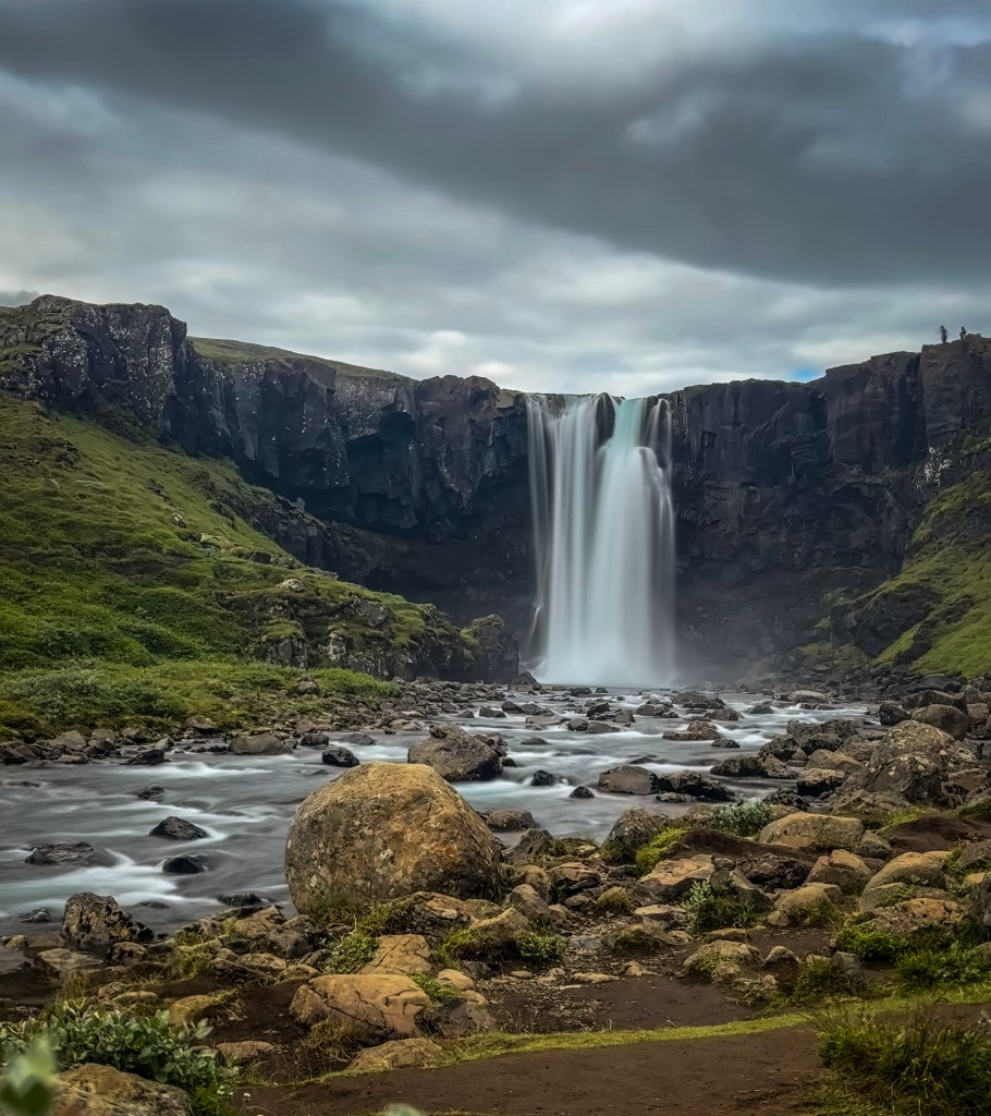
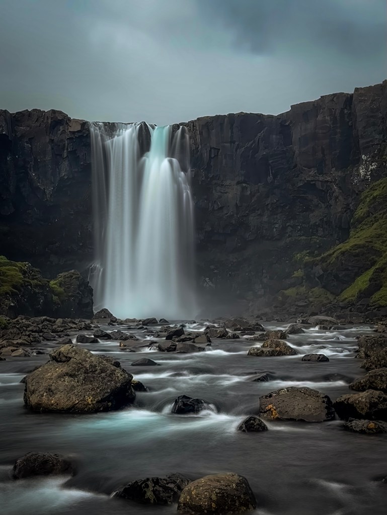
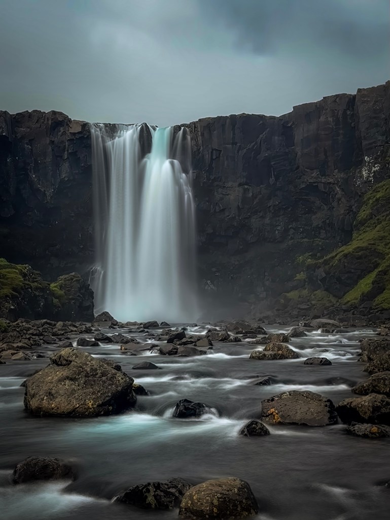
Just outside Seyðisfjörður, Gufufoss drops in a single, broad curtain over a dark basalt cliff into a boulder-strewn river. Under the heavy cloud cover that day, the black rock and misty spray gave the scene an almost moody, cinematic feel—a good warm-up for the dramatic landscape still ahead.
Rjúkandafoss
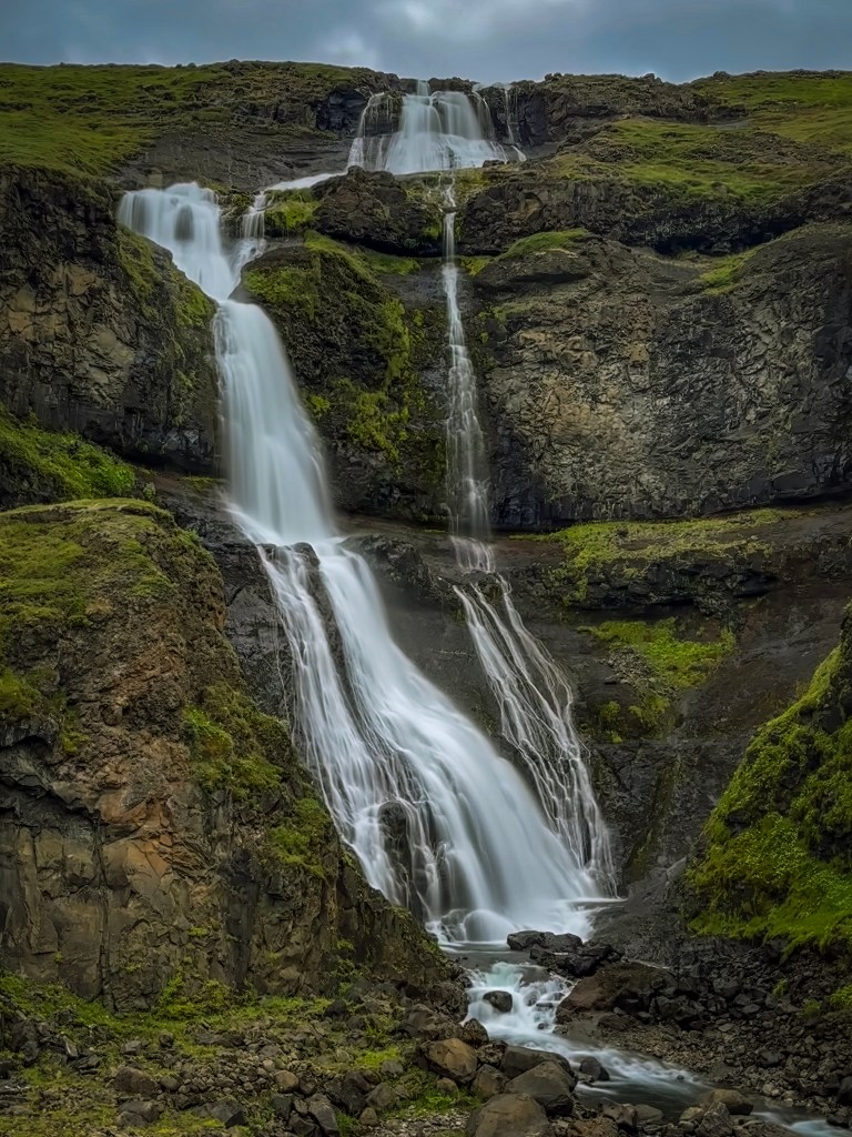
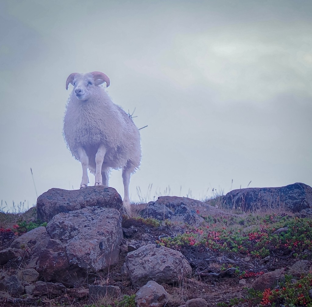
Rjúkandafoss is a multi-tiered cascade that tumbles down a mossy hillside in a series of drops rather than one clean plunge, spreading into thin, braided ribbons of water lower down. It’s a lovely, photogenic stop, and one that rewards a little patience — this is where I finally managed to catch an Icelandic sheep posing on a rock right at the edge of the falls.
I’d been trying to get a good shot of the local sheep the whole trip, and this one obliged, standing on a rock outcrop with the falls behind, looking almost like it knew it was being photographed.
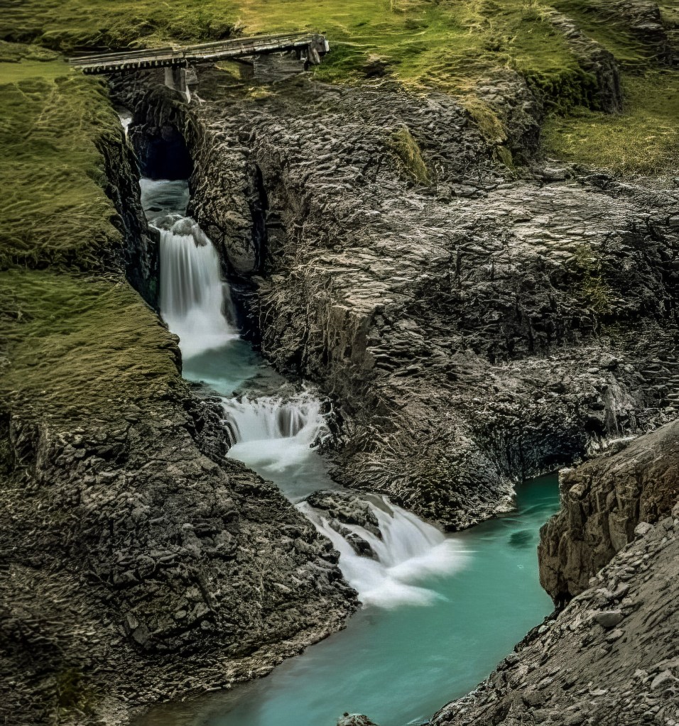
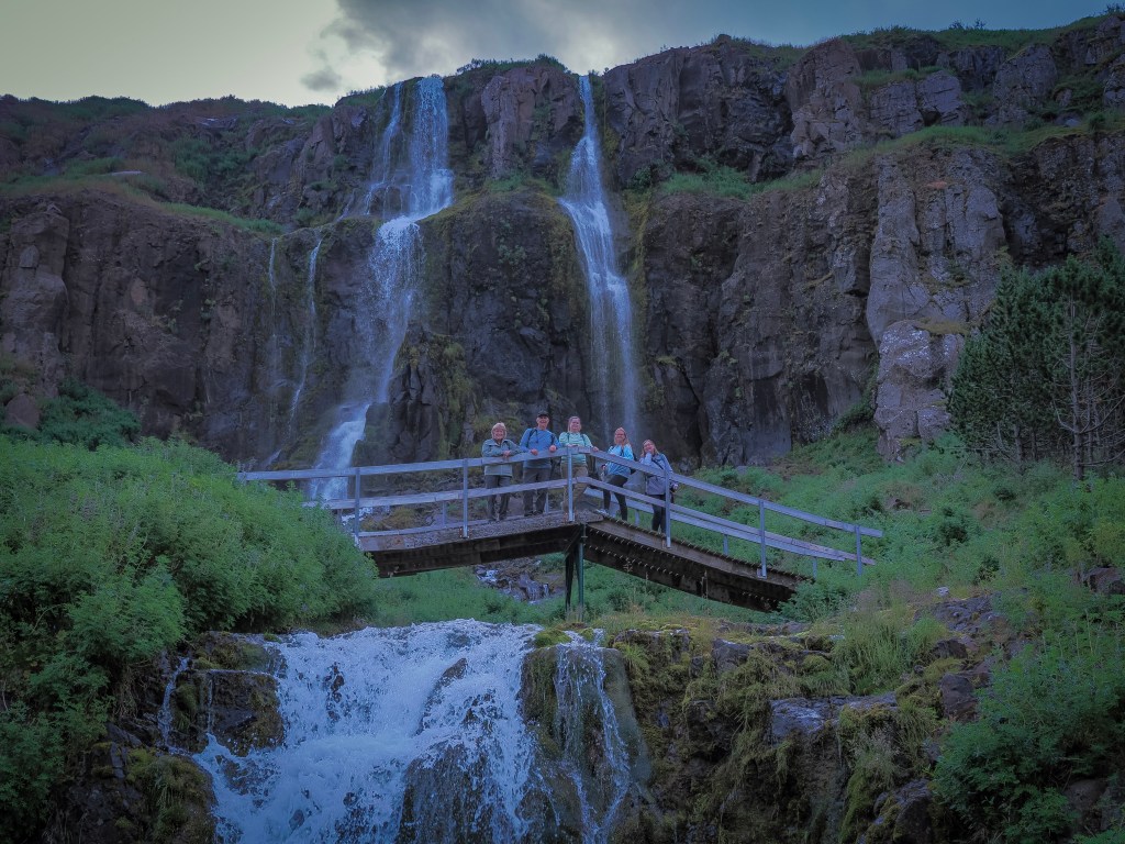
Below the main falls, the water steps down through a narrow rocky channel into a series of turquoise pools, with an old wooden footbridge crossing overhead — a quieter, smaller-scale companion to the main cascade.
Stuðlagil Canyon
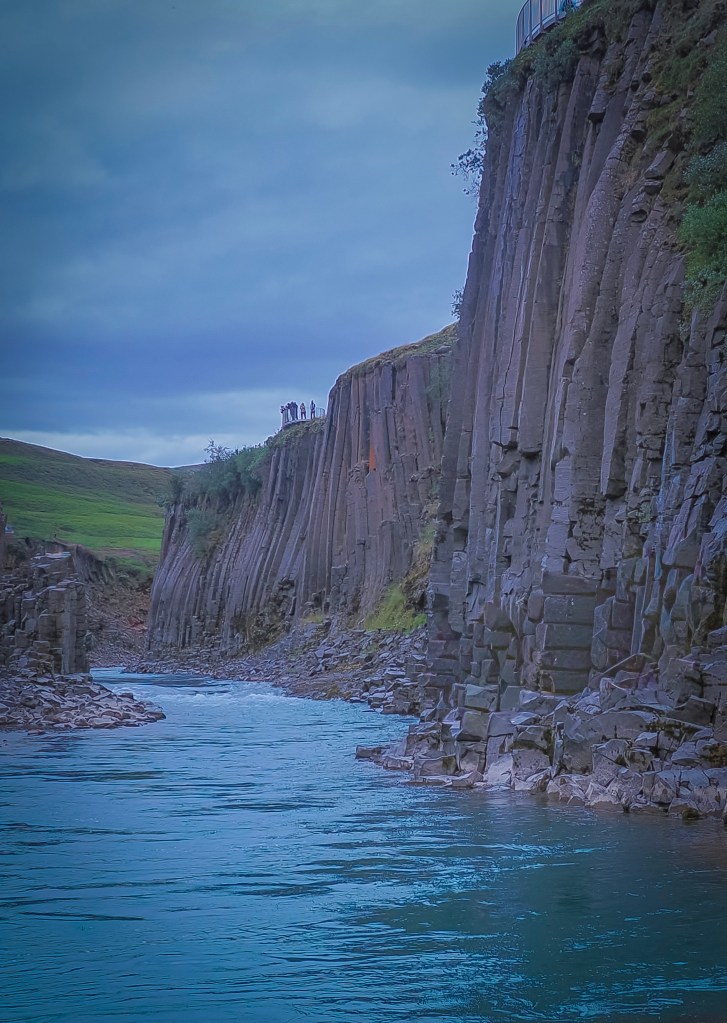
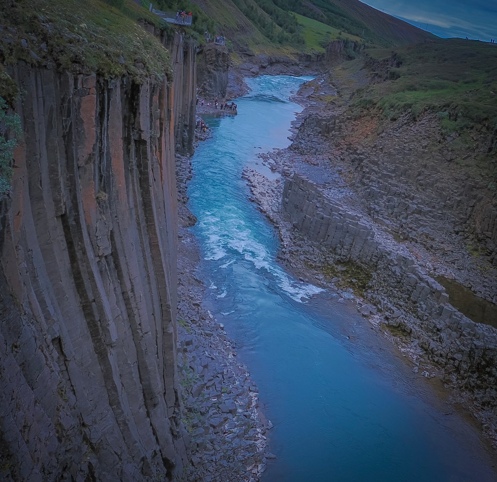
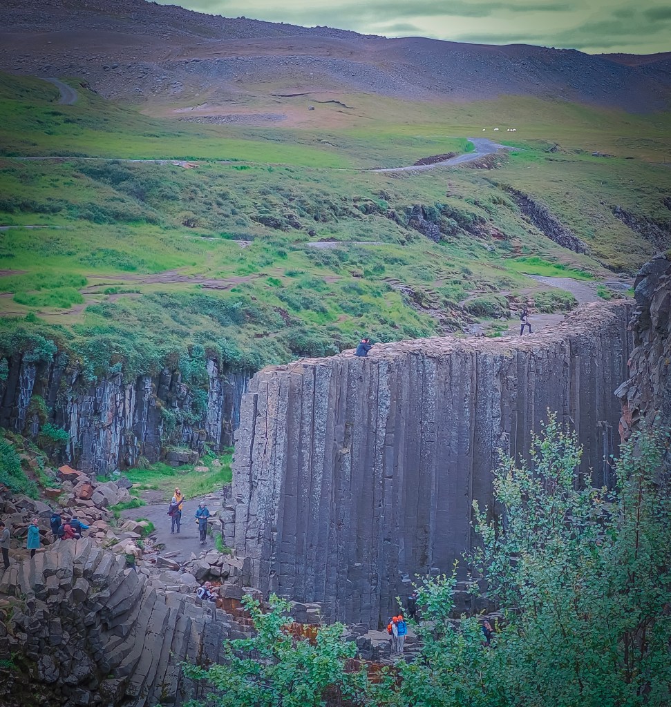
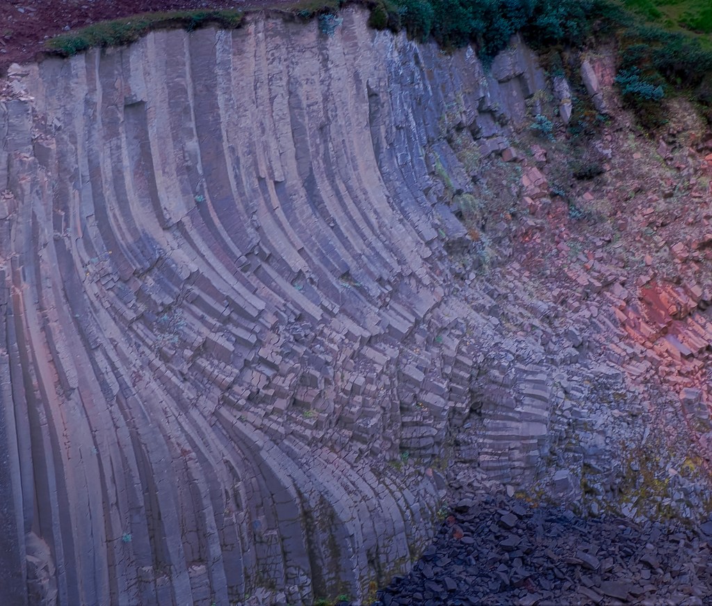
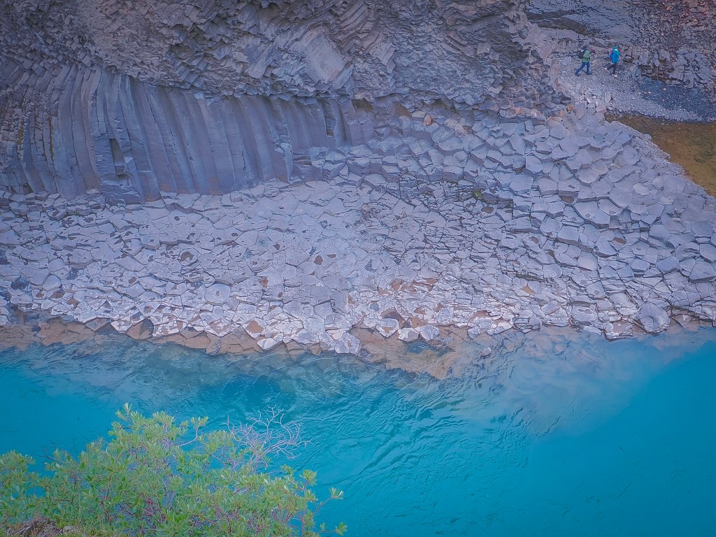
Nothing quite prepares you for Stuðlagil. Towering, tightly packed hexagonal basalt columns rise straight out of a glacial river that runs an almost unreal shade of turquoise — a color and geology combination that really is unique to Iceland.
How the canyon was discovered: What makes Stuðlagil especially remarkable is how recently it came to light. The basalt columns stayed hidden under the rushing waters of the Jökla River for centuries. That changed with the Kárahnjúkar hydropower project, built between roughly 2006 and 2009, which redirected much of the river’s flow into the Hálslón Reservoir and unexpectedly dropped water levels by several meters, exposing the rock formations that had been submerged for thousands of years. Even so, the canyon largely went unnoticed by the outside world for several more years — it was local shepherds who first came across it in 2016, and it wasn’t until it appeared in an Iceland tourism campaign that same year that it became widely known and turned into one of the country’s most photographed spots.
East side-More access but longer hike
Getting there: two parking lots, two very different experiences
There are two parking areas for the canyon — one on the west side and one on the east side — and they offer quite different visits:
West side: The quicker, more accessible option. From the west parking lot, you have two choices: take the stairs and follow the marked path along the rim, or head left, which takes you down to the canyon floor for a closer, water-level view.
East side: This side offers the better overall experience of the canyon, but it comes at a cost — it requires a considerably longer hike from the parking area to reach the viewpoints.
From the first (main) east-side parking lot near the wooden bridge, the hike to the canyon viewpoint is about:
~1 hour each way (roughly 2 hours round trip)
Distance-wise, that’s about 4 km (2.5 miles) each way
If you’re able to drive further in — across the bridge and down the rougher track to the second east-side lot near Stuðlafoss waterfall (best done with a 4×4, ~7–8 minutes of rough driving) — you cut off a good chunk of that, saving roughly 30 minutes each way.
So in practice:
First lot only: ~2 hours round trip
Second lot (4×4 recommended): ~1 hour round trip
Since we were on a tight schedule to get back to the ship in time, we had to take the west parking lot. It was still spectacular, but I’d love to go back someday and do the east side hike properly for those better views.
One nice bonus on the west side: from the observation point right at the parking lot, you can also see a small waterfall tucked into the canyon — an unexpected little extra we weren’t specifically looking for.
Parking lot addresses & GPS
Both sides are reached by turning off the Ring Road (Route 1) onto Road 923, then onto the gravel Jökuldalsvegur — there’s no street “address” as such, since it’s rural farmland, so GPS coordinates and the Google Maps search names below are the most reliable way to navigate.
West side (near Grund farm): Search “Stuðlagil Canyon,” “Stuðlagil West Side Parking,” or “Stuðlagil Canyon Main Access” in Google Maps. Approximate coordinates: 65°09’48.6″N, 15°18’26.3″W (65.1635, -15.3073). This is the larger, easier-access lot with paid restrooms, plus a gift shop and food truck.
East side (near Klaustursel farm): Search “Stuðlagil East Side Parking” or “Stuðlagil (Bridge parking).” Approximate coordinates: 65.1879, -15.2854. This first lot sits right next to a white wooden bridge over the Jökla River. A second, rougher lot (“Parking Klaustursel” / “Parkplatz Klastrusel”) lies further in near Stuðlafoss waterfall — reachable by 4×4 in about 7–8 minutes, or on foot, and it shortens the hike considerably.
Other helpful tips for visiting
Fees: The west-side lot at Grund charges a parking fee (around 1000 ISK per car), which also covers restroom access. There are no facilities at all on the east side, so plan accordingly.
Footwear: Wear sturdy, grippy shoes — the east-side trail is rugged in places and the rocks near the water can be slippery.
Timing: The east-side hike runs roughly 1 hour each way (2 hours round trip) from the first parking lot, or about 30 minutes less if you can drive to the second lot. The west side is a much quicker in-and-out via a metal staircase (roughly 240 steps).
River color: The water is at its most vivid turquoise from spring through mid-summer; by late summer, increased glacial melt can turn it a silty gray, so visiting earlier in the season helps for photos.
Safety: The Jökla is considered one of the more dangerous rivers in Iceland — stay well back from unprotected edges, especially in wet or windy conditions.
En route bonus: Look out for Stuðlafoss, a basalt-column waterfall along the east-side trail — a nice photo stop partway through the hike.
If short on time (like us): The west side is the better choice for a quick, guaranteed view without committing to a multi-hour hike — just know you’ll be looking across the river rather than standing among the columns.
Even from the west side, the scale of the columns and the color of the water made it easy to see why this place, hidden for so long, has become one of Iceland’s most talked-about natural sights.
Seyðisfjörður is the Most Photographed Town in East Iceland, and there is a reason for it.
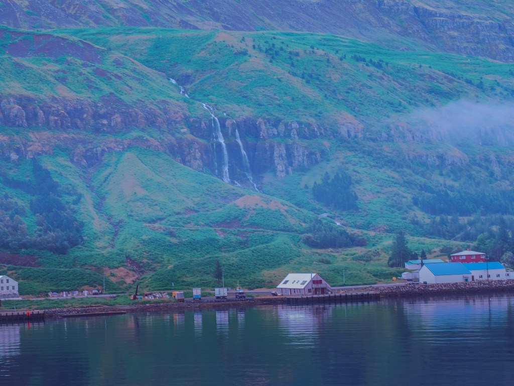
After two rainy days in a row, Seyðisfjörður finally gave us sun — and it turned out to be the perfect town for it. We woke up to the ship easing into the fjord, and the first thing that hit me wasn’t the colorful houses or the church everyone talks about; it was the waterfall. There’s a huge one sitting right above the town, practically part of the skyline, tumbling down the mountainside as if it’s built into the place. Waking up to that view, after grey skies at the glacial lagoon and again at Mývatn, felt like Iceland had finally decided to show us its bright side.
We got off on the first tender so we’d have the town mostly to ourselves before the crowds came ashore, and just wandered. Seyðisfjörður is small enough that “wandering” is basically the whole itinerary — it’s a town of roughly 676 people tucked at the end of a fjord, ringed by steep mountains, and every direction you look has either colorful timber houses, cascading water, or both.
Rainbow Street and the Blue Church
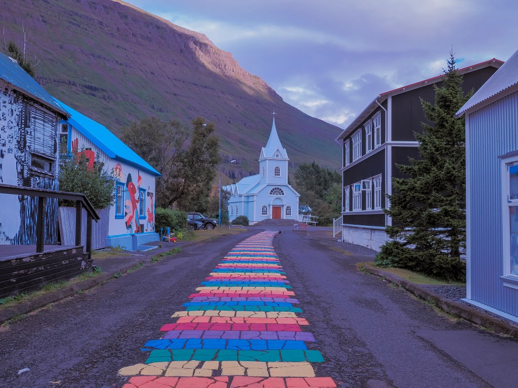
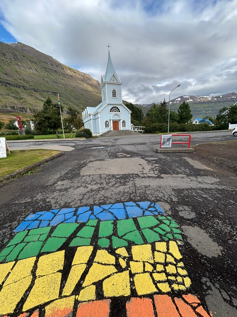
This is the image everyone has of Seyðisfjörður before they’ve even been there — a street painted in rainbow stripes leading straight up to a vivid blue church. The church itself was actually built in Norway back in 1894 and shipped to Iceland in pieces, which explains the distinctly Norwegian-style timber architecture that runs through the whole town. The rainbow street below it (officially Norðurgata) was painted as a community project and has become the town’s unofficial symbol. Getting there early on the first tender paid off — by the time we looped back through later, the street was noticeably busier.
The Ferry Town
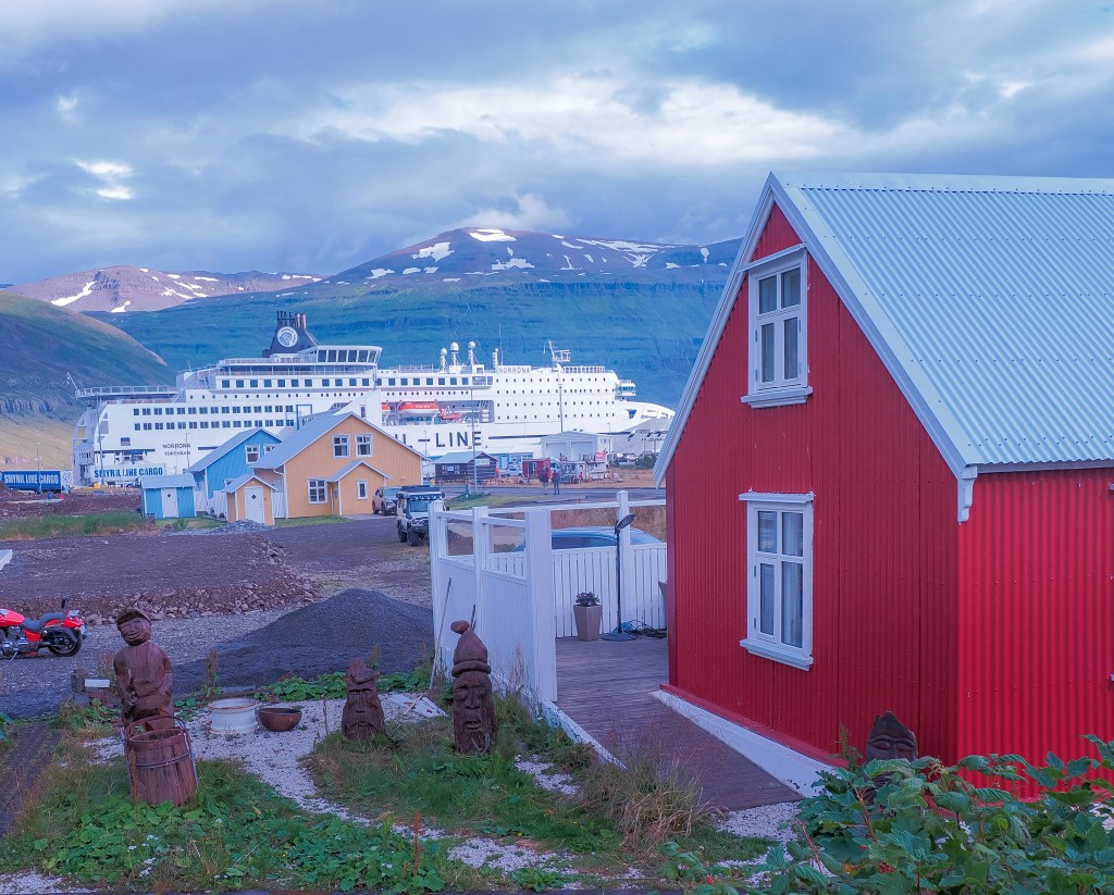
Wandering further along the harbor, we noticed a long line of RVs rolling off a large ship docked nearby, and it took us a minute to place it — Seyðisfjörður is the arrival port for the Smyril Line’s Norröna ferry, which connects Iceland to the Faroe Islands and Denmark. It’s the only sea link between Iceland and mainland Europe, so for a lot of travelers with their own vehicles, this sleepy little fjord town is their actual entry point into the country. Watching a ferry’s worth of camper vans unload right into this tiny, colorful village was a strange, fun contrast — modern road trips pouring into a town that looks like it hasn’t changed in a century.
There’s a bit of irony in arriving here by cruise ship, too: after years of large ships bringing waves of day-trippers into such a small harbor, Seyðisfjörður became the first town in Iceland to put limits on cruise tourism, capping how many visitors could come ashore at once to keep the town from being overwhelmed. Taking the first tender in suddenly felt like good timing, not just preference.
A Fjord With a Long Memory
For a town this small, Seyðisfjörður carries a surprising amount of history. Archaeologists have dated the remains of an old farmstead here to the 10th century, with even older burial finds pointing to settlement in the 800s—making this one of the earliest-inhabited corners of Iceland, according to legend, first claimed by a settler named Bjólfur, after whom the mountain looming over the town is named. The town itself didn’t really take shape until the mid-1800s, when Norwegian herring fishermen settled the fjord, which explains why so much of the architecture still looks transplanted from Norway rather than native Icelandic. A Norwegian-born merchant named Otto Wathne became something of a local legend in that era, and the town still has a monument to him. The fjord’s naturally sheltered harbor also meant it was often first in line for new technology — Iceland’s first telephone line reportedly ran through here before reaching the rest of the country — and during World War II, the town served as one of the Allies’ main bases in Iceland.
More recently, in December 2020, Seyðisfjörður was hit by a series of landslides — including the largest ever recorded to strike an urban area in Iceland. No one was killed, but over a dozen buildings were destroyed, some historic timber houses among them, and the town was cut off for a time while it recovered. Walking those same streets in the sun, it was hard to picture, but it added a layer of resilience to a town that already felt like it punched above its weight.
Around Town
Beyond the church and the street, Seyðisfjörður has a genuine creative pulse. The Skaftfell Art Center anchors the town’s art scene, and out along the water there’s the Tvísöngur sound sculpture — a set of five interconnected concrete domes designed around Iceland’s tradition of five-tone harmony, each dome resonating with a different note when you stand inside it. There are a couple of other public art pieces worth hunting down too: a sculpture marking the laying of Iceland’s first undersea telegraph cable in 1906, which effectively connected the country to the rest of the world for the first time, and another piece the town commissioned as a gift to itself for its 100th anniversary back in 1995. The whole town has apparently been a filming location too, including a scene from The Secret Life of Walter Mitty, which honestly checks out — it does have that “too picturesque to be real” quality on camera.
The Waterfall Behind Town
That waterfall we spotted from the ship has a name — Búðarárfoss —, and it’s an easy 5-to-10-minute walk up from the town center, with a great view back down over the harbor and the rainbow street from above. For anyone with more time, a longer trail follows the Fjarðará River upstream through a small forested stretch, passing several more falls (the river reportedly has around 25 of them scattered along its length) on the way to the larger Gufufoss waterfall further up the valley.
From Seyðisfjörður: Stuðlagil Canyon
After an hour of roaming the town, we booked a Viator day tour out to Stuðlagil Canyon and its waterfalls — one of East Iceland’s most striking natural sites, and dramatic enough that it deserves its own post. We used this Viator tour from Seyðisfjörður to Stuðlagil Canyon
Things to Do Around Seyðisfjörður
If you have more time here than a short shore excursion, this little fjord town has more range than it first lets on:
Visit Gufufoss– Situated on the outskirts of Seyðisfjörður, Gufufoss stands 88ft tall. It gets its name from the Icelandic “gufu”, meaning steam, referring to the water spray caused by the plunging falls. We visited as part of this Viator tour on our way to Studlagil Canyon.
Walk the Fossastígur trail — an easy riverside path from town leading up through forest toward Fjarðarsel, home to Iceland’s oldest still-operating power plant (1913), with berries lining the trail in late summer.
Hike Vestdalur valley — a longer trail past waterfalls and up to a small lake, known for plant life you won’t see elsewhere in the area; a longer route continues on toward the neighboring Borgarfjörður valley.
Climb one of the peaks flanking the fjord — Mt. Bjólfur (1,085 m) to the west and Strandartindur (1,010 m) to the east are the two most prominent summits, and the local hiking club has set up logbook boxes on seven surrounding peaks as part of a self-guided “Mountain Club” challenge, complete with a punch-card map available from the tourist information center.
Follow the trail toward Gullþúfa — starting from Sörlastaðir along the Sörlastaðaá river, this route climbs to the highest point south of town.
Visit Skaftfell Bistro — housed in the same building as the art center, and a good stop for a meal with a side of local art.
Cool off (or warm up) at the pool — the town has a public swimming pool and hot tubs on Suðurgata, plus a nine-hole golf course at Hagavöllur for anyone traveling with clubs.
Time it for the LungA Arts Festival — if you’re visiting in July, this international arts festival takes over the town for a week and draws artists from all over.
Take a day trip further afield — Stuðlagil Canyon and the Vök Baths near Egilsstaðir are both popular longer excursions from Seyðisfjörður, and in winter, East Iceland’s valleys are one of the only places in the country where wild reindeer still roam.
Drive (or admire) the Fjarðarheiði mountain pass — Route 93 between Egilsstaðir and Seyðisfjörður climbs to around 600–630 meters and is considered one of Iceland’s most scenic drives, with waterfalls cascading on both sides of the descent into town.
Getting to Seyðisfjörður
Most visitors arrive one of two ways:
By road: Seyðisfjörður sits 27 km (about 30 minutes) from Egilsstaðir via Route 93, over the Fjarðarheiði pass. It’s a spectacular drive, but check the road.is in winter — the pass can close in bad weather.
By sea: Besides cruise ship tenders like ours, this is the only Icelandic port served by an international ferry — the Smyril Line’s Norröna, arriving weekly from Tórshavn (Faroe Islands) and Hirtshals (Denmark), a popular option for travelers bringing their own car or RV into Iceland.
There’s no direct bus service into town from outside East Iceland — Egilsstaðir is the regional hub for buses and flights, with a short taxi or drive from there.
Whatever brings you here, give the town at least a couple of unhurried hours. The whole point of Seyðisfjörður seems to be slowing down enough to actually look at it.
Picture a landscape so strange it looks like it belongs on another planet — steaming vents hissing out of blood-red earth, lava towers rising from still blue water, and craters scattered across the ground like giant footprints.
That’s Mývatn.
Mývatn means “midge lake” — it’s known (and sometimes notorious) for its swarms of midges in summer, which in turn support one of the richest bird populations in Iceland, especially ducks. The day we visited, it was rainy, and we didn’t deal with midges, but people suggest bringing head/face nets to protect against them.
If the glacial lagoon was Iceland showing off its ice, Lake Mývatn was Iceland showing off everything underneath it. It was another rainy day — the second time on this trip that gray skies rolled in right before we reached somewhere completely unique — and by now I was starting to notice the pattern. We reached the area as a shore excursion off our cruise, docked in Akureyri, and the tour packed in Goðafoss, Dimmuborgir, Námaskarð (Hverir), Lake Mývatn itself, and the Skútustaðagígar pseudo-craters — all in one day. It’s a strange, fitting itinerary, because Mývatn isn’t really one attraction; it’s a whole landscape shaped by fire, water, and steam, and by the end of the day we’d basically toured the geology textbook version of how Iceland was built.
Lake Myvatn
Tucked into northern Iceland, this shallow volcanic lake and its surrounding badlands feel like the country’s best-kept secret. Formed by a massive lava eruption over two thousand years ago, Mývatn is ringed by pseudocraters, black lava fields, bubbling mud pots, and geothermal baths that rival Iceland’s more famous hot spots. Add in some of the richest birdlife in the country, a real chance of catching the Northern Lights, and a landscape so alien it stood in for another world on screen, and you’ve got a destination that rewards anyone willing to go a little further north.
A few highlights
Location: In the Skútustaðahreppur area of North Iceland, near the town of Akureyri.
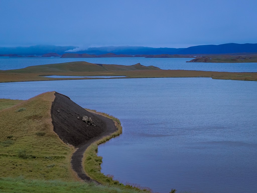
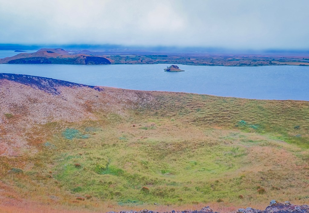
Volcanic origin: The lake formed about 2,300 years ago from a large basaltic lava eruption. It’s shallow and famous for its unusual landscape of pseudocraters (volcanic-looking mounds formed by steam explosions, not actual volcanoes) and lava pillars.
Wildlife: Mývatn means “midge lake” — it’s known (and sometimes notorious) for its swarms of midges in summer, which in turn support one of the richest bird populations in Iceland, especially ducks.
Geothermal activity: The whole region sits on the Krafla volcanic system, so there are many hot springs, mud pots, and steam vents nearby.
Best time to visit
Summer (June–August): Warmest weather, near-endless daylight, all roads open — but also peak midge season (bring a head net, seriously) and more tourists. The day we visited in mid-August, it was raining, and we didn’t see any midges.
Winter (Nov–March): Fewer bugs, chance of Northern Lights over the lake, and the Nature Baths feel incredible in the cold. Downside: shorter days and some roads/trails can be icy or closed.
Shoulder season (May or September): Good middle ground — decent light, thinner crowds, midges mostly dormant.
Things to do around the lake
Mývatn Nature Baths – geothermal spa with lake views, much less crowded than the Blue Lagoon.
Dimmuborgir – easy walking trails through eerie lava rock formations.
Hverfjall – short, steep hike up a huge volcanic crater with panoramic views.
Krafla & Víti crater – active geothermal area with a striking blue-green crater lake.
Námaskarð (Hverir) – bubbling mud pots and steaming vents, otherworldly and easy to access.
Höfði – peaceful lakeside park, good for birdwatching and photos of the pseudocraters.
Grjótagjá – a small lava cave with a geothermal pool (yes, the Game of Thrones cave).
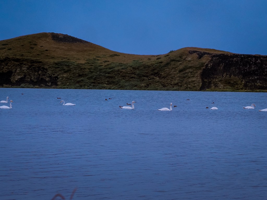
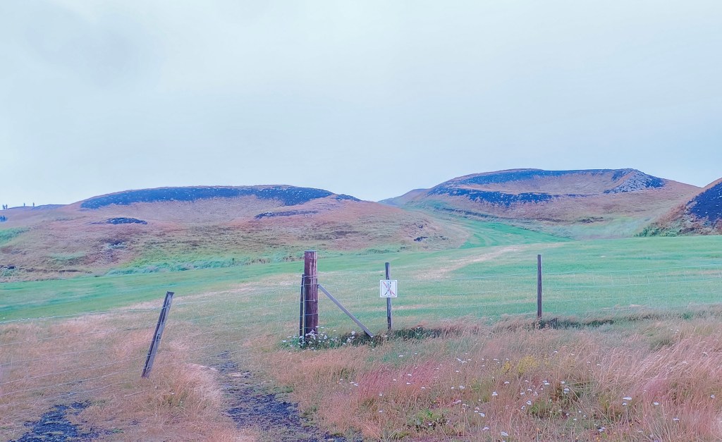
Pseudocrates Swans and other birds swimming in Lake MyvatnPseudocrates
How to Spend a Day or Two on the Diamond Circle
You can also visit Mývatn as part of the Diamond Circle. Set your alarm early, because this is the day you’ll be talking about for years.
Base yourself in Mývatn or Akureyri and start the morning with a short drive to Goðafoss, the “Waterfall of the Gods.” You can also do this trip the other way around and end at Goðafoss. If you start with Goðafoss, arrive before 8 a.m., and there’s a good chance you’ll have the thundering, horseshoe-shaped falls almost entirely to yourself — just you, the roar of the water, and the low morning light catching the spray ( We did this as the last stop on our trip, and it was busy with lots of people)
From there, point the car north toward Húsavík, Iceland’s whale-watching capital. If you’ve got the extra hours to spare, this is worth building your whole day around: humpbacks, minke whales, and white-beaked dolphins all frequent these waters, and a boat tour here rivals anything you’ll find further south. Even if you skip the boat, the harbor town itself is worth a wander and a coffee before you push on.
Next stop is Ásbyrgi Canyon, a huge, forested, horseshoe-shaped gorge that feels like it doesn’t belong in Iceland at all. Legend says it’s the hoofprint of Sleipnir, Odin’s eight-legged horse — and honestly, standing at the base of those sheer cliff walls, it’s easy to believe. It’s an easy, flat walk, which makes it a perfect lunch-stop detour.
Then comes the main event: Dettifoss, Europe’s most powerful waterfall. Nothing quite prepares you for the sound of it — a deep, constant roar you feel in your chest before you even see the falls. The east-side viewpoint gets you closer to the action (though the gravel road takes some patience), while the west side is paved and a bit more forgiving if you’re short on time. We skipped this one on our trip because we were really waterfall-ed out by then. We had seen 7-8 waterfalls at various stops within Iceland and didn’t want to spend time seeing yet another waterfall.
By mid-afternoon, swing through Hverir, also known as Námaskarð — a stretch of land so barren and sulfurous it looks like it was lifted straight off another planet. Mud pots gurgle, steam hisses out of the ground, and the smell of sulfur hangs in the air. It’s strange, a little unsettling, and completely unforgettable. If you have been to Yellowstone, this might not impress you much, but still a good place to stop
Save the best for last: end your loop back at Mývatn with a soak in the Nature Baths, milky-blue geothermal water steaming against the evening sky. After a day of waterfalls, whales, canyons, and craters, there’s no better way to let it all sink in.
Know before you go: this route covers 250–300 km of driving, so if you have two days rather than one, split it in half — Goðafoss and Húsavík on day one, the rest on day two. Either way, the Diamond Circle delivers more raw, varied Icelandic landscape in a single loop than almost anywhere else in the country.
For Game of Thrones Fans
If the landscape around Mývatn feels strangely familiar, that’s because you’ve probably seen it before — just with more snow and a few White Walkers thrown in. The area was a favorite filming location for Game of Thrones, and two spots are must-visits for fans:
Grjótagjá — a small lava cave hiding a striking blue geothermal spring, best known as the setting for Jon Snow and Ygritte’s cave scene. Swimming is no longer allowed since the water temperature became unpredictable, but you can still peer inside and admire the steaming water and lava walls.
Dimmuborgir — the dramatic lava field just south of the lake, which stood in for Mance Rayder’s Wildling army camp beyond the Wall. We’ve got a full guide to Dimmuborgir’s formation, folklore, and parking fees if you want to dig deeper before you go.
The two sites sit just a few kilometers apart, so it’s easy to knock them both out in under an hour if you’re building a GoT-themed detour into your Mývatn day.
Visiting Lake Mývatn & the Diamond Circle
Mývatn sits in North Iceland, about 480–500 km from Reykjavík — this is not a day trip from the capital, so plan for either a multi-day North Iceland trip or a stop on a full Ring Road loop.
Getting there from Reykjavík:
Self-drive: Take the Ring Road (Route 1) north — roughly 6–7 hours of driving, one of Iceland’s classic long hauls. Akureyri makes a natural overnight stop, sitting about 6 hours from Reykjavík and just an hour from Mývatn.
Fly + drive: The faster option — a roughly 45-minute domestic flight from Reykjavík to Akureyri, then rent a car for the last hour to Mývatn. This is the route we effectively mirrored, since we arrived by ship into Akureyri rather than driving up.
Bus: Possible but slow — around 8–9 hours via Strætó, with a change in Akureyri.
Getting around once you’re in the area:
If arriving via Akureyri (by ship, flight, or drive), most of the Diamond Circle sites — Goðafoss, Dimmuborgir, Hverir, Mývatn, and Skútustaðagígar — can be covered in a single well-paced day, either self-driven or with a guided day tour, which is exactly the format our shore excursion used.
Goðafoss sits right along the main road between Akureyri and Mývatn, making it a natural first or last stop.
Dimmuborgir, Hverir, and Skútustaðagígar all cluster close together near Reykjahlíð, the small village that serves as the area’s hub for fuel, food, and lodging.
Wear closed shoes with good grip at Hverir — the terrain is uneven, and the ground can be genuinely hot in spots. Stick to marked paths everywhere in the geothermal areas.
If you have time, the Mývatn Nature Baths (sometimes called the “Blue Lagoon of the North”) make a good way to end the day — geothermal soaking with volcanic views, usually less crowded than the original Blue Lagoon.
Of everything I saw in Iceland, this is the moment that made me go “WOW” — the glacial lagoon at Jökulsárlón.
By the time we got to Glacial Lagoon, we’d already had a few days of big Icelandic moments. A South Coast tour had checked off waterfalls and black sand beaches. We’d been out whale watching. We’d sailed toward Heimaey hoping to see puffins, but the weather had other plans — the boat never docked, and we spent the whole day out at sea instead, puffin-less. So when the day came to visit the glacial lagoon from Djúpivogur, I wasn’t expecting much. It started raining before we’d even left, and I’d more or less made peace with a quiet, gray day.
Then we arrived, and I honestly couldn’t believe what I was looking at.
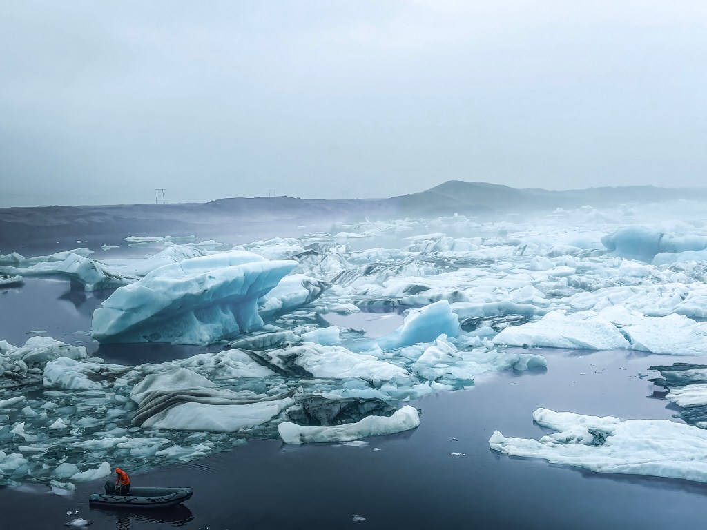
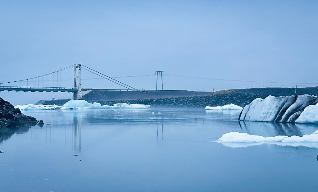
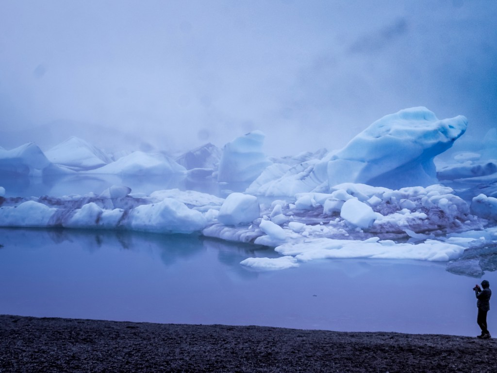
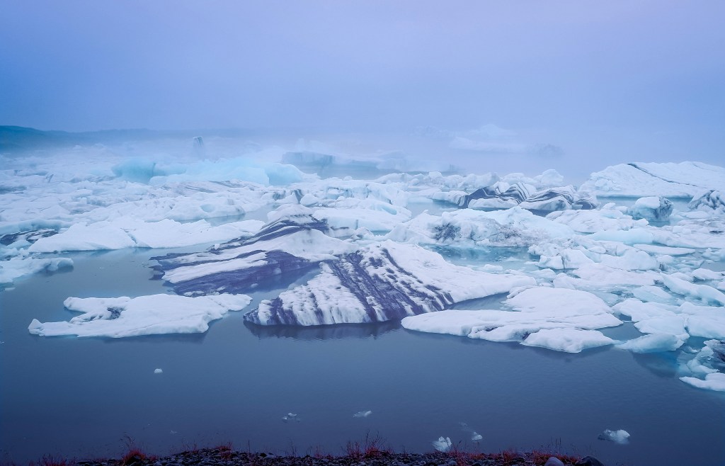
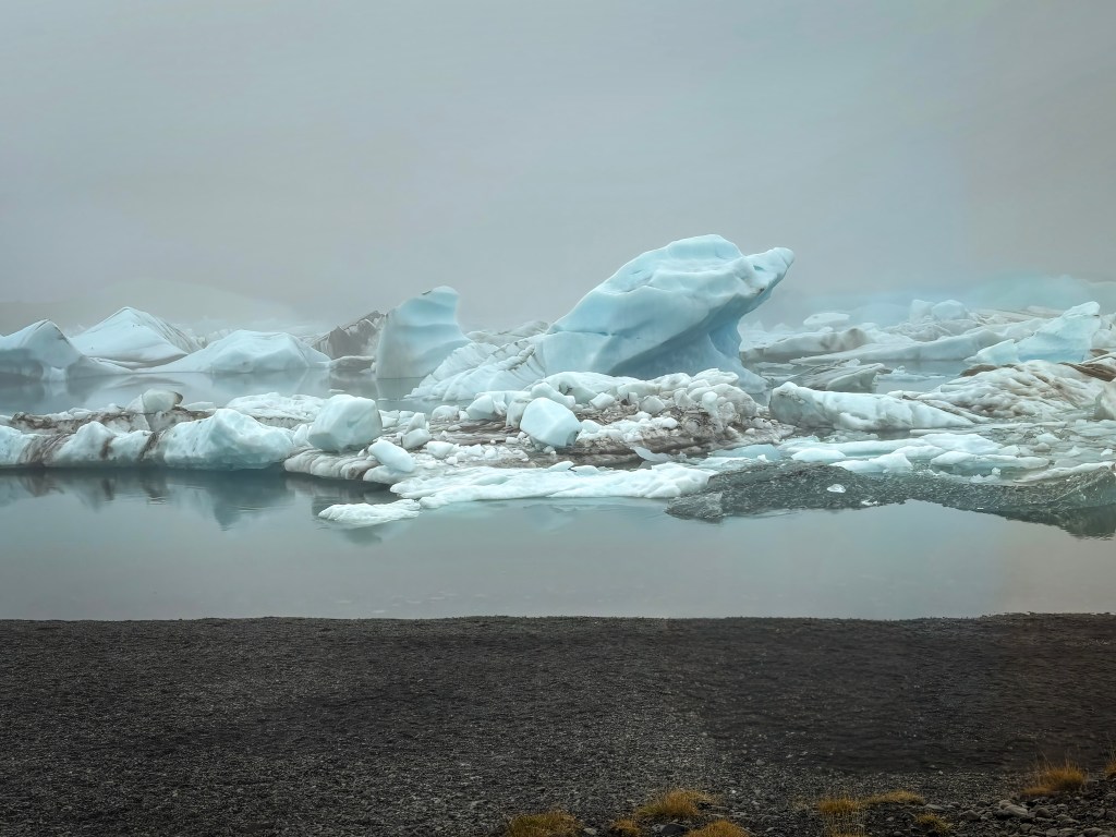
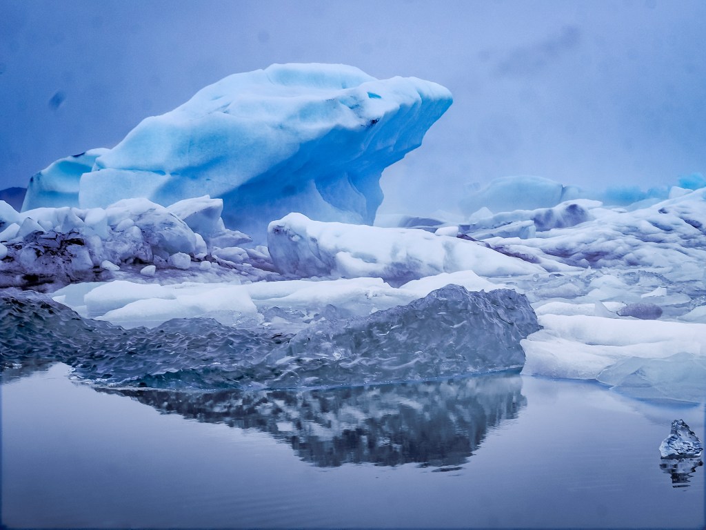
I’d seen glaciers before. I’d even walked on the Athabasca Glacier in Banff, so it wasn’t as if ice was new to me. But this was something else entirely. It wasn’t one solid sheet of ice to walk across — it was hundreds of broken chunks, scattered across a still, dark lagoon, each one catching light in a different way. Some were nearly clear, some a deep glacial blue, some streaked black and white where volcanic ash and sediment had been folded into the ice over centuries. The volcanic landscape doesn’t just sit near the lagoon — it shapes it, staining the ice with these strange, striped patterns you won’t see anywhere else.
Diamond Beach
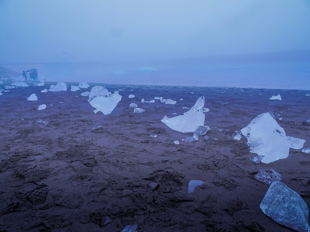
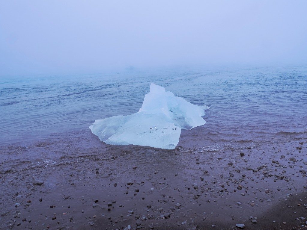
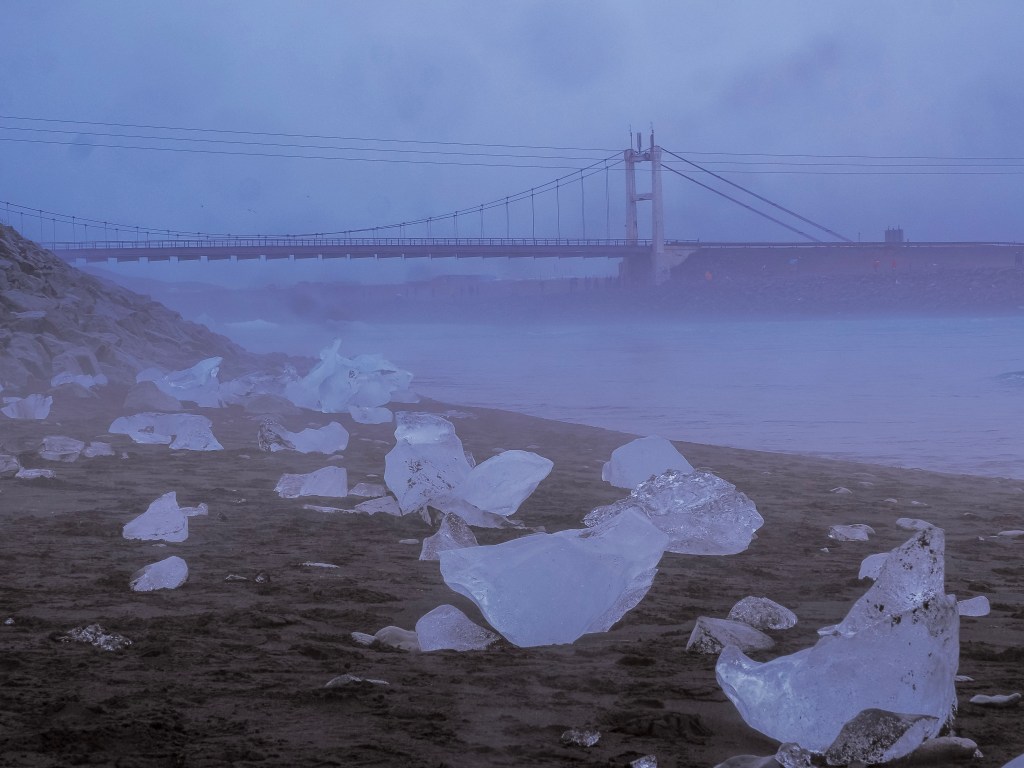
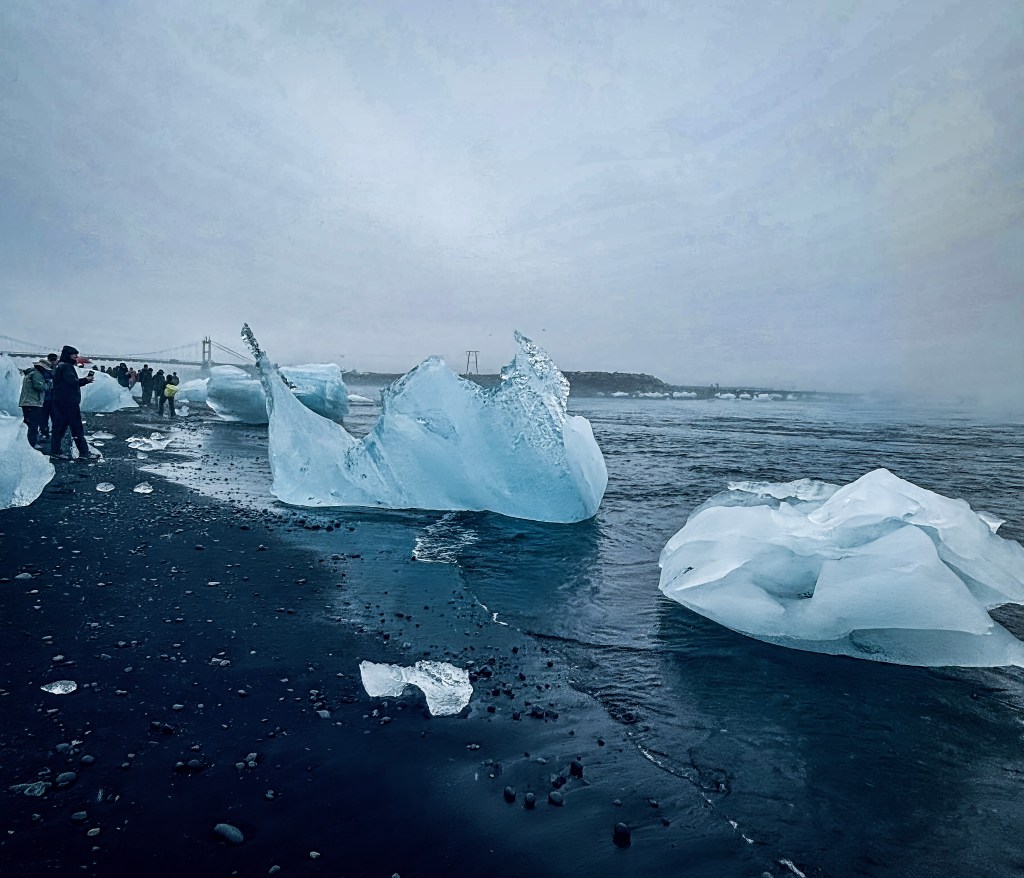
And then there’s Diamond Beach, the black sand shoreline just across Route 1 from the lagoon, where the current carries smaller iceberg chunks out to sea and the waves wash them back onto the sand. Against the black volcanic sand, the ice looks exactly like scattered diamonds — hence the name. If you want to actually see a beach full of them, timing matters: go at low tide. At high tide, a lot of that ice gets pulled back out or covered, and you’re left with far fewer “diamonds” on the sand.
What stuck with me most, though, was how the rain made it better, not worse. The gray sky flattened the light just enough that the blues in the ice seemed to glow from within instead of glaring in the sun. It felt less like a postcard and more like standing somewhere that wasn’t entirely real. Surreal is overused, but I don’t have a better word for it.
Visiting the Glacial Lagoon from Reykjavík
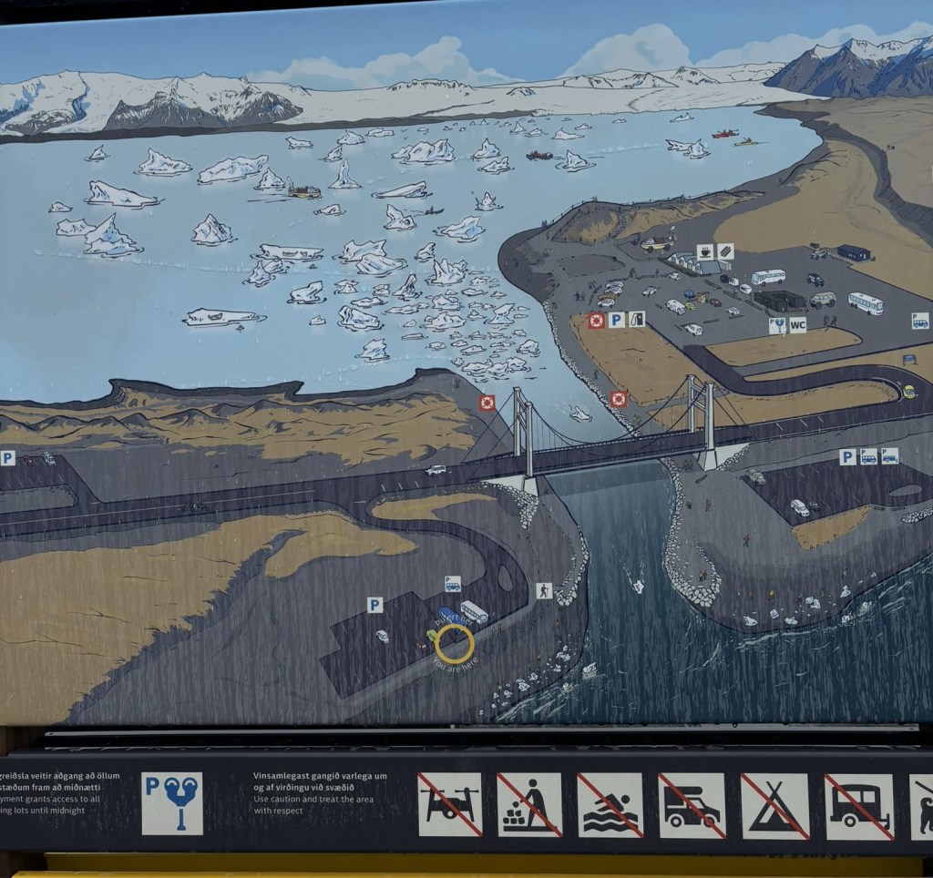
Jökulsárlón sits in southeast Iceland, right on the Ring Road (Route 1), inside Vatnajökull National Park — fed by the Breiðamerkurjökull glacier, part of Vatnajökull, Europe’s largest ice cap. It’s about 378 km (roughly 240 miles) east of Reykjavík, a drive of around 4.5 to 5 hours on the Ring Road, and the distance means it’s not really a there-and-back-in-a-day trip from the capital.
Getting there:
Self-drive: Leave central Reykjavík on Route 49, merge onto Route 1 heading southeast, and stay on it for around 375 km until you see the signposted turn for the lagoon, which leads straight into the car park. The drive itself is one of Iceland’s best, passing Seljalandsfoss, Skógafoss, the Vík black sand coast, and Skaftafell along the way.
Guided tour: Most visitors combine it with a South Coast day tour from Reykjavík, or see it as part of a full Ring Road circuit. Since we came in from Djúpivogur on the east side, we approached from the opposite direction — a good reminder that the lagoon works as a stop whether you’re circling the Ring Road clockwise or counter-clockwise.
Public transport: There’s no public bus service to Jökulsárlón — it’s only reachable by car or organized tour.
Once you’re there:
The lagoon itself is free to walk along, and you don’t need to book anything to see the icebergs from shore. Boat tours (amphibious trucks or Zodiacs) run seasonally and get you out among the ice for a closer look, with the option to sail right up near the icebergs.
Diamond Beach is a two-minute walk or drive across Route 1 from the lagoon car park. Check the tide times before you go — low tide is when the most ice piles up on the sand.
A minimum visit is about 1.5 hours for the lagoon and Diamond Beach together; budget 2.5–3 hours if you want a boat tour too, and closer to 4 if you’re stopping for food at the small café by the car park.
Stay well back from the water’s edge — waves can arrive without warning on these beaches, and the ice can shift suddenly.
When to go: The lagoon is worth visiting any time of year. Summer brings boat tours and long daylight; winter brings the chance to pair it with ice cave tours and a shot at the northern lights. We went when the weather wasn’t cooperating at all, and it still turned out to be one of the best days of the whole trip. If the forecast looks gray, don’t let that stop you — it might just make the ice glow a little bluer.
What makes Jökulsárlón and Diamond Beach so unique? I got curious about why I’d never seen anything like it before, even at other glaciers — and it turns out the lagoon is rarer than it looks. Unlike most glacial lakes, which are landlocked and just sit there melting, Jökulsárlón connects to the Atlantic through a short tidal channel, so seawater actually mixes with the meltwater and the tides push in and out every day. That connection is the whole reason Diamond Beach exists at all: icebergs don’t just melt in place; they drift toward the sea, ground near the channel mouth, and eventually break through, where the waves wash the smaller pieces back onto the black sand next door. Landlocked lakes have nowhere for the ice to go, so there’s no “beach” stage anywhere else. Add in the fact that the lagoon is Iceland’s deepest lake at nearly 250 meters, letting massive icebergs — some over a thousand years old — float freely instead of grounding out, and that the black-and-white streaks in the ice are volcanic ash compressed into the glacier over centuries, and you get a combination of tidal lagoon, volcanic terrain, and an exposed coastline that barely exists anywhere else on Earth. It also helps that the whole thing is young: a century ago none of this existed, and the lagoon has quadrupled in size since the 1970s as the glacier keeps retreating, so you’re really watching a landscape still in the middle of forming itself.
Just fifteen minutes from the cobblestone streets of Old Quebec, there’s a waterfall that makes Niagara look short. Literally — Montmorency Falls stands at 83 meters, nearly 30 meters taller than its world-famous cousin. And yet somehow it stays off most travelers’ radar until they’re already booking their Quebec City trip and stumble across a photo that makes them do a double take.
I did exactly that. And I’m so glad I made the trip.
First Impressions: A Wall of White Water
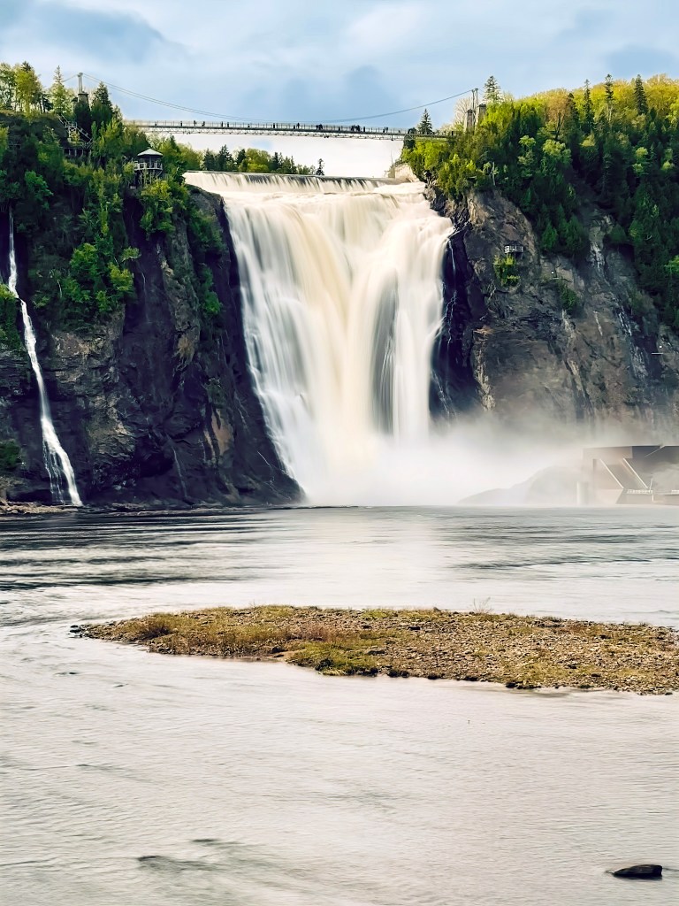
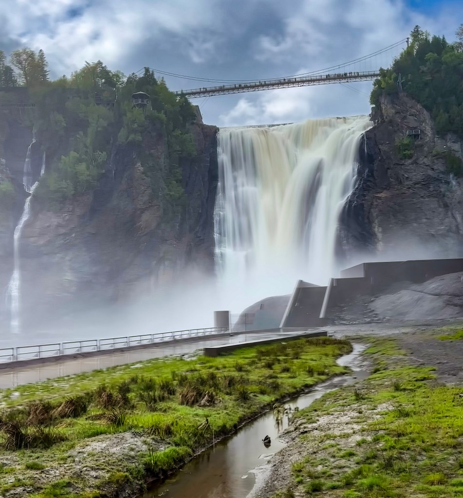
Nothing quite prepares you for your first look at Montmorency Falls from the base. The Montmorency River pours over a dark, moss-streaked cliff face in a single dramatic curtain, throwing up so much mist that it drifts across the whole basin like fog rolling in off the sea. On the day I visited, the water ran heavy and churned almost golden-white at the base — spring runoff, I was told, makes the falls even more thunderous than usual.
Smaller ribbons of water trickle down the cliffs on either side of the main falls, almost like the mountain itself is sweating from the effort of holding back the main event. It’s easy to just stand at the shoreline for twenty minutes, watching the spray catch the light, before you even think about moving closer.
Crossing the Suspension Bridge
The real showstopper, though, is walking across the pedestrian suspension bridge that spans the top of the falls. It’s suspended right at the point where the river tips over the edge, so you’re essentially standing above the drop with the entire cliff and basin sprawled out beneath you. The bridge sways gently underfoot — enough to remind you exactly how high up you are — and the roar of the water below drowns out most conversation.
Pro tip: don’t rush this part. Pause halfway across and look straight down. Watching the river accelerate right before it disappears over the edge is one of those moments that photos never quite capture, though you’ll try anyway.
The View From Above
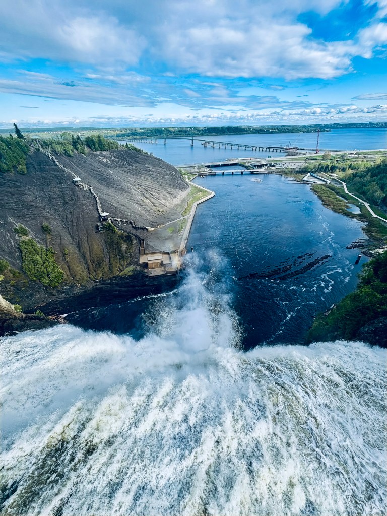
From the top of the cliff, the perspective flips entirely. Instead of looking up at a wall of falling water, you’re looking down over it — past the frothing crest of the falls, through the rising mist, to where the river fans out into a wide, calm basin dotted with little gravel islands. On a clear day you can trace the whole scene out toward the St. Lawrence River, where the Île d’Orléans bridge stretches across the water in the distance and the far shoreline rolls off into green hills.
It’s a genuinely dizzying vantage point — parts of the old hydroelectric infrastructure are visible clinging to the base of the cliff, dwarfed by the sheer scale of the falls above them, which gives you a real sense of just how much water is moving through this narrow gorge every second.
Getting Around the Park
Parc de la Chute-Montmorency is set up to let you experience the falls from every conceivable angle:
The cable car glides up the cliffside for those who’d rather skip the stairs (or save their legs for later).
The Panoramic Staircase — all 487 steps of it — zigzags down alongside the falls for anyone who wants the full up-close, misty-face experience. It’s a workout, but the switchback views make it worth every step.
Ziplining is available for the more adventurous, sailing right over the base of the falls.
Via Ferrata routes let climbers scale the cliffside rock face for an even more adrenaline-heavy perspective.
Even if you skip all the extras, simply walking the network of trails and viewpoints around the top and base of the falls will easily fill a couple of hours.
Practical Tips
Timing: Go earlier in the day if you can — the light hits the falls beautifully in the morning, and crowds build up by early afternoon, especially in summer.
What to wear: Bring a light rain jacket or expect to get misted, particularly near the base and on the suspension bridge when the wind shifts.
Season matters: Spring brings the most dramatic water volume from snowmelt; winter transforms the falls into a surreal ice formation nicknamed “the sugar loaf,” when frozen spray builds into a cone at the base. Both are worth planning a trip around.
How to get there: It’s a quick 15–20 minute drive or a short bus ride from downtown Quebec City, making it an easy half-day trip that pairs well with a morning or afternoon in Old Quebec.
Extend the Day: Île d’Orléans
If you’re already standing at the top of the falls, you’ve probably noticed the long bridge stretching out toward an island in the distance — that’s Île d’Orléans, and it’s an easy, worthwhile add-on to a Montmorency Falls day trip. The bridge crossing is just a few minutes past the park, so there’s very little extra driving involved for a lot of extra charm.
The island itself feels like a completely different pace of Quebec. Rather than cliffs and waterfalls, you get rolling farmland, roadside fruit stands, and a scattering of small villages that have kept much of their 17th- and 18th-century character. It’s often called the “Garden of Quebec,” and for good reason — the island is dense with orchards, vineyards, and berry farms.
A few things worth doing once you’re there:
Drive the loop road that circles the island — it’s about 67 km and takes you through all six of the island’s villages, each with its own stone church and waterfront views back toward Quebec City and the falls.
Stop for local food and drink. The island is known for its cider houses, small wineries, and maple products, and roadside stands sell strawberries and other produce in-season. It’s a great place to pick up a picnic.
Wander Sainte-Famille or Saint-Jean, two of the prettiest villages, with old stone houses and quiet harbor views.
Catch the view back toward the falls. From certain points along the island’s western shore, you get a completely different perspective on Montmorency Falls and the St. Lawrence — worth the stop just for the photo.
Because the island is small and the loop road is relaxed, you can easily fold a few hours here into the same day as your falls visit — starting with the roar and mist of Montmorency in the morning, then unwinding with orchard views and cider tastings on Île d’Orléans in the afternoon.
Why It’s Worth the Trip
Montmorency Falls has this rare quality of feeling both wild and completely accessible — a genuinely massive natural spectacle you can reach without a long hike or a wilderness trek. Whether you’re peering over the suspension bridge, catching your breath partway up the staircase, or just standing at the water’s edge letting the mist settle on your face, it’s the kind of place that turns a quick stop into an unplanned hour of just watching the water fall.
If Quebec City is on your itinerary, don’t let this one slip past as a footnote. Pair it with an afternoon on Île d’Orléans, and you’ve got one of the best half-day-turned-full-day excursions the region has to offer.
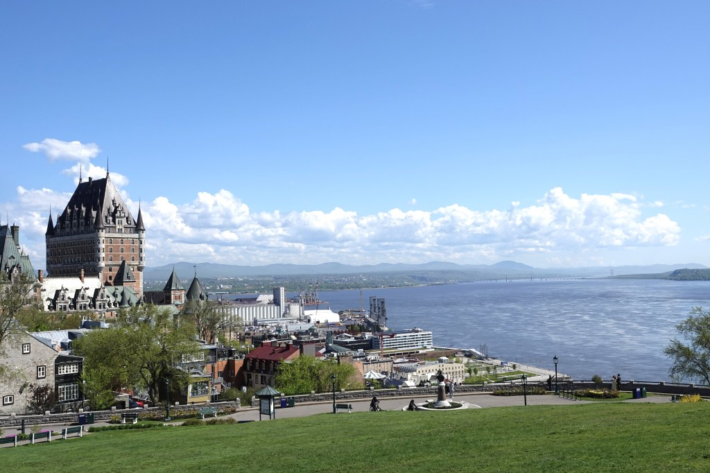
Few places in North America let you walk through four centuries of history in a single afternoon quite like Old Québec City. Cobblestones wind past 17th-century stone houses, murals tell stories of the people who built a nation, and every corner seems to open onto a postcard view of the St. Lawrence River. This walking route starts at the city’s most iconic landmark, Château Frontenac, and loops down through Lower Town before climbing back up — five unmissable stops that together capture the soul of Old Québec.
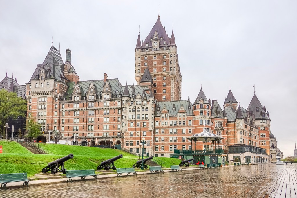
Start where most visitors do: at the foot of the Fairmont Le Château Frontenac, the castle-like hotel that has defined Québec City’s skyline since the late 19th century. Since we were staying at this hotel, this was a logical starting point for us. Wrapping around its base is Dufferin Terrace, a long wooden boardwalk that began as a private walkway for the governors who once lived on this site. It was opened to the public in 1838, then dramatically extended in 1879 under the direction of Lord Dufferin — a name you’ll encounter again later on this walk.
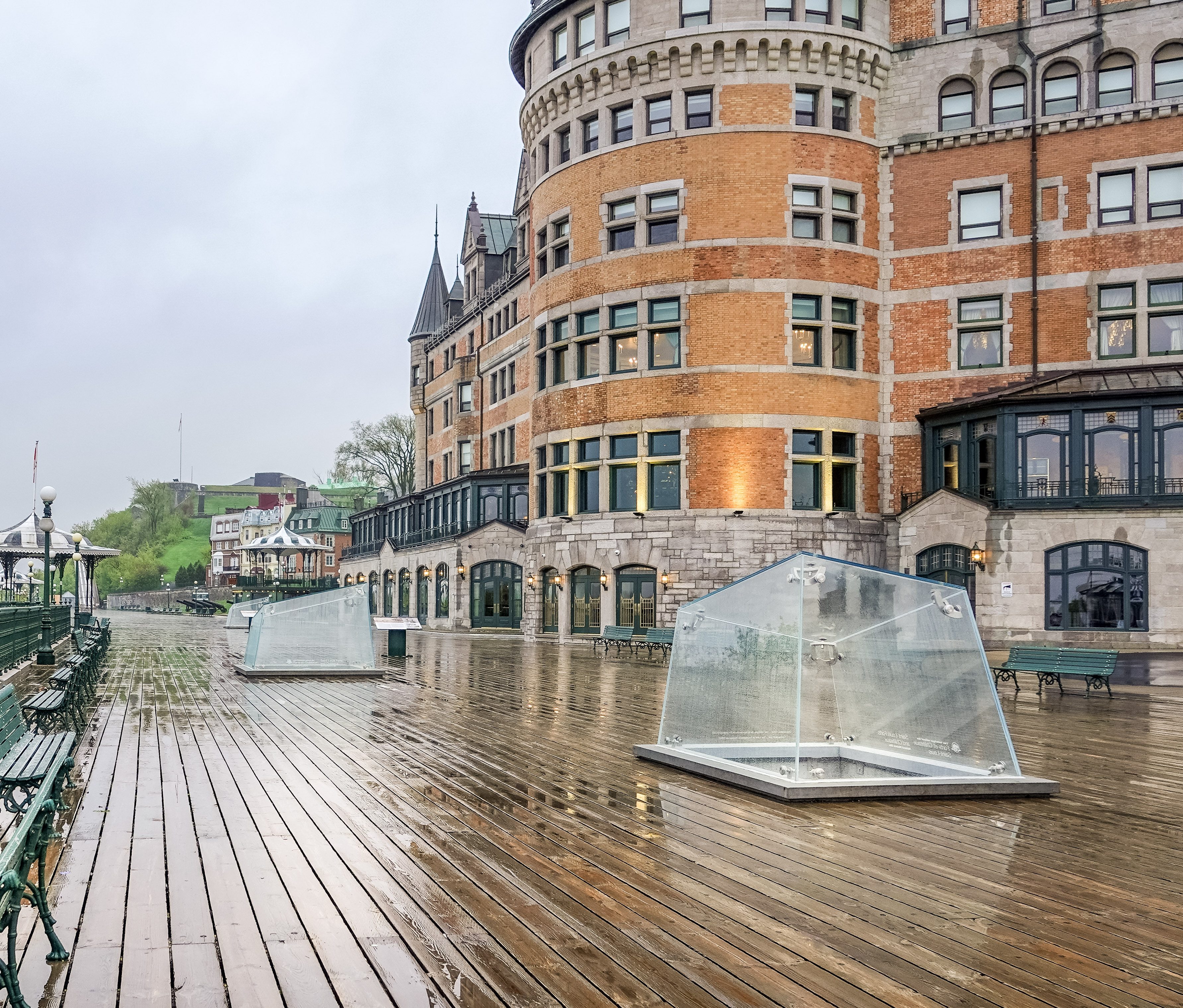
Today the terrace stretches roughly 425 meters along the cliff edge, lined with green-and-white gazebos and offering sweeping views across the St. Lawrence River toward Lévis. It was also the first public space in North America to be lit by electric streetlamps, back in 1885. In winter, a historic toboggan slide draws crowds; year-round, street performers and musicians keep the promenade lively. At its far end stands a statue of Champlain, and the terrace connects onward to the Governors’ Promenade and a cliffside walkway toward the Plains of Abraham.
What is beneath Dufferin Terrace?
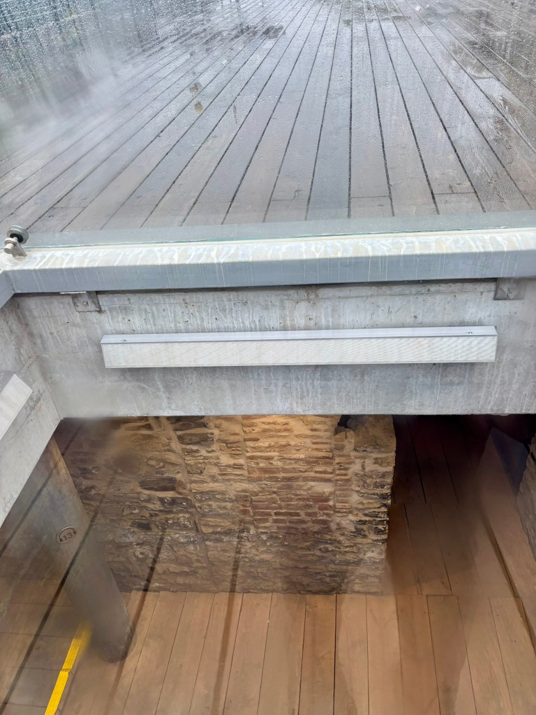
As you walk the terrace, look through the “archeoscopes”—protective glass viewing prisms built directly into the terrace floor, and you can peer straight down into the remarkably preserved stone and brick masonry of the old kitchens, outbuildings, and cold-storage basements. What you are seeing is the Saint-Louis Forts and Châteaux National Historic Site, an expansive underground archaeological crypt containing the excavated ruins of the official residence for French and British colonial governors. Initiated in 1620 by Samuel de Champlain, this former seat of power went through centuries of fortifications, renovations, and fires until it was completely destroyed by a final blaze in 1834, after which the public promenade was built over the remains. You can actually tour these remains by purchasing tickets Frontenac Kiosk (on the Dufferin Terrace).
Down to Quartier Petit-Champlain
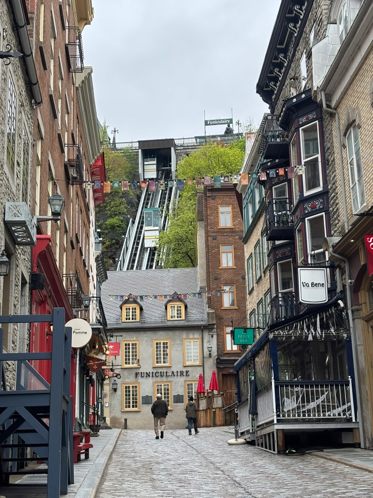
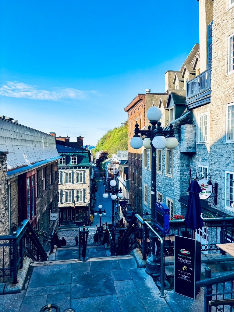
From the terrace, take the funicular — running since 1879 — or walk down the Breakneck Stairs (Escalier Casse-Cou), Québec City’s oldest staircase, dating to around 1635, for one of the most photographed views in the city. Either route drops you into Rue du Petit-Champlain, a narrow, colorful pedestrian street widely regarded as the oldest commercial artery in North America.
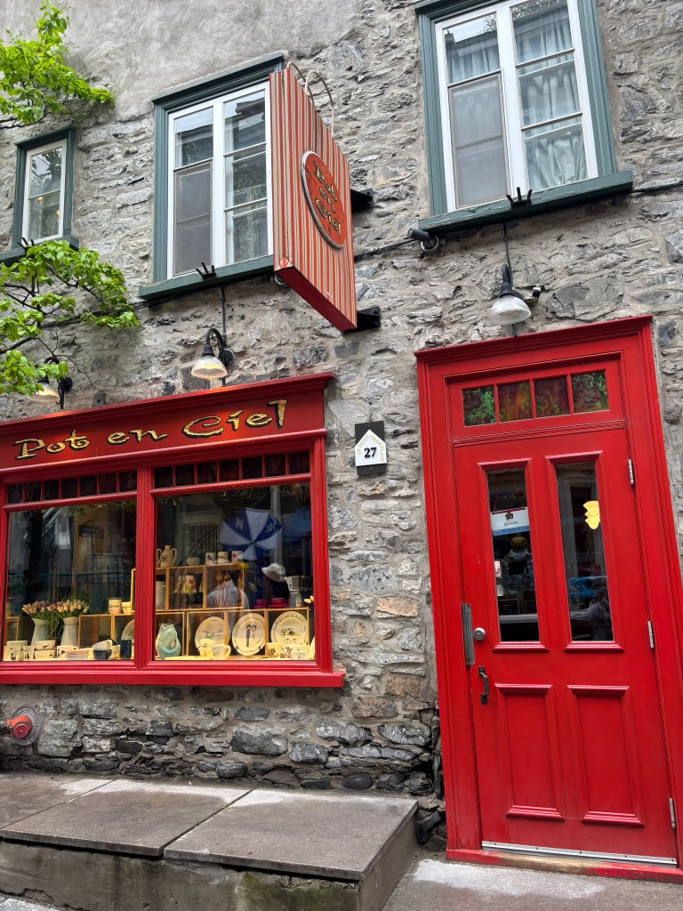
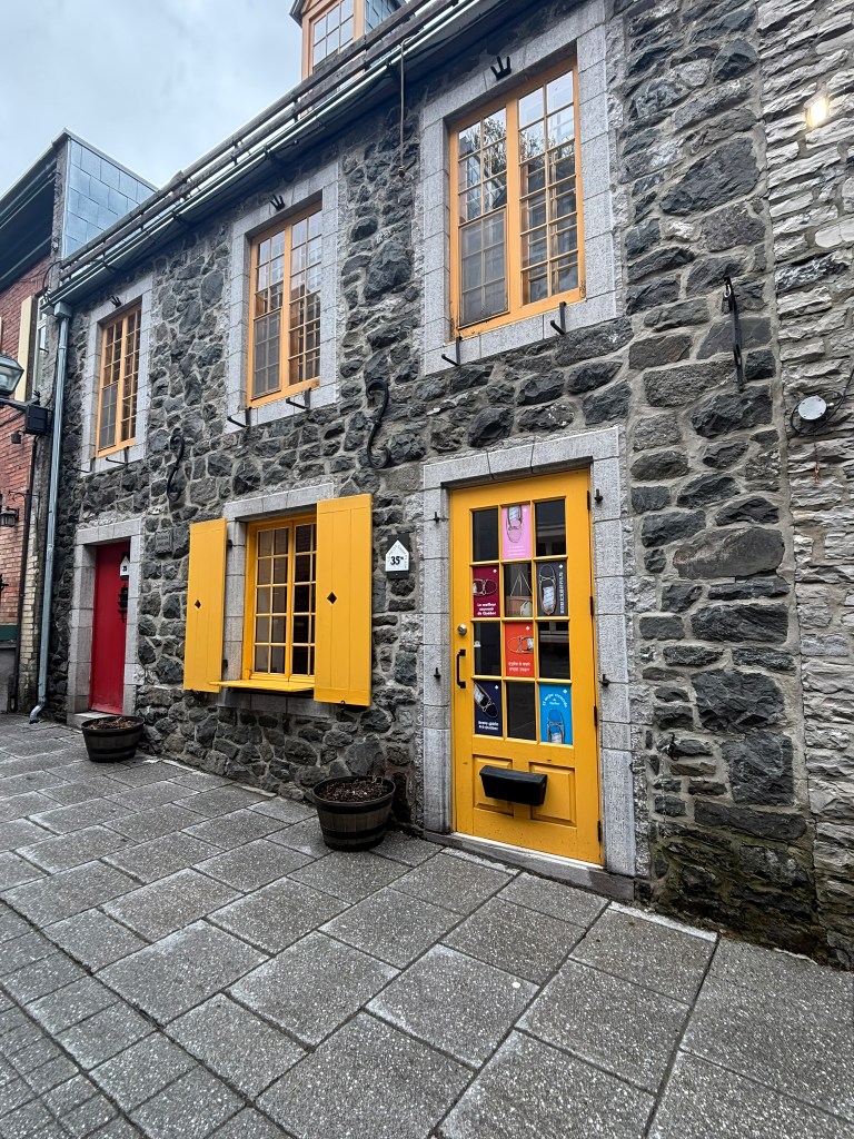
Named for Champlain himself, the street has been home to fishermen, artisans, and merchants since the earliest days of the colony, though it fell into disrepair by the 19th century and was largely reinvented as the boutique-lined district visitors know today starting in the 1970s. It rewards a slow wander: independent boutiques, cozy cafés, and — especially in winter — string lights and holiday décor that turn the whole street into something out of a Christmas card.
Place-Royale
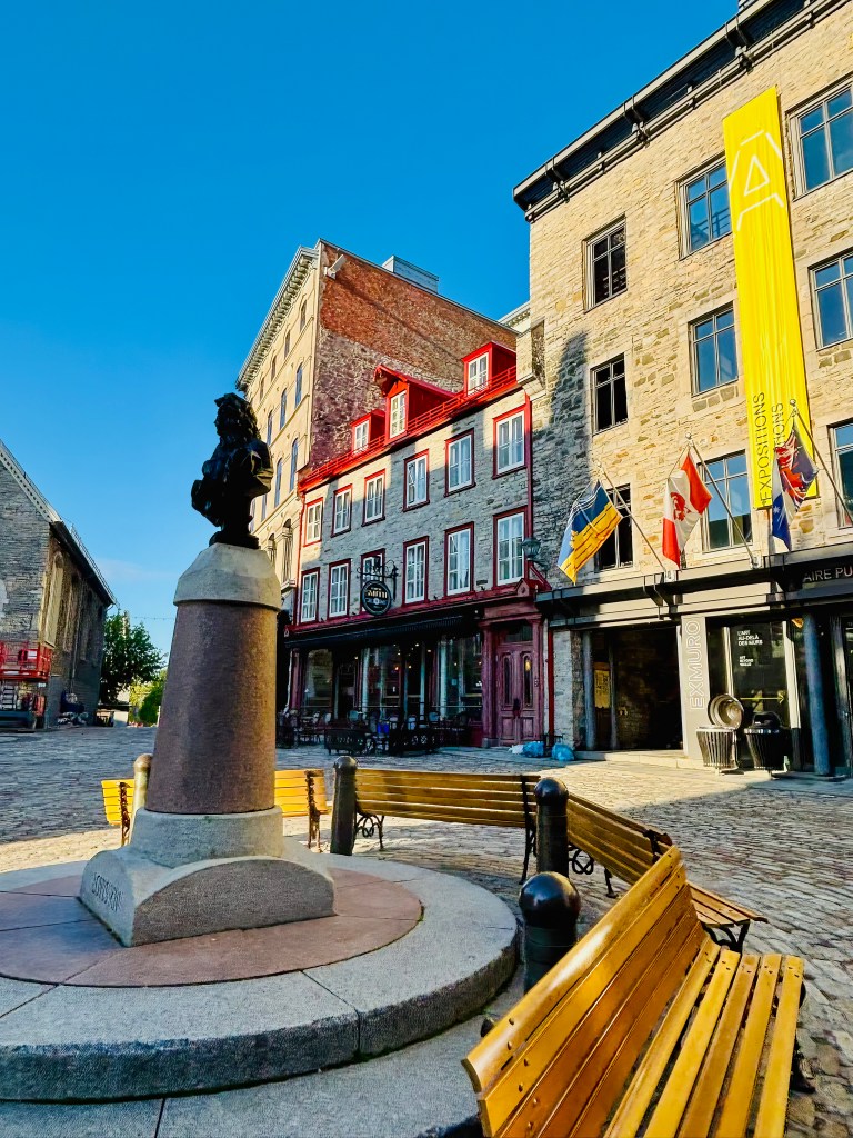
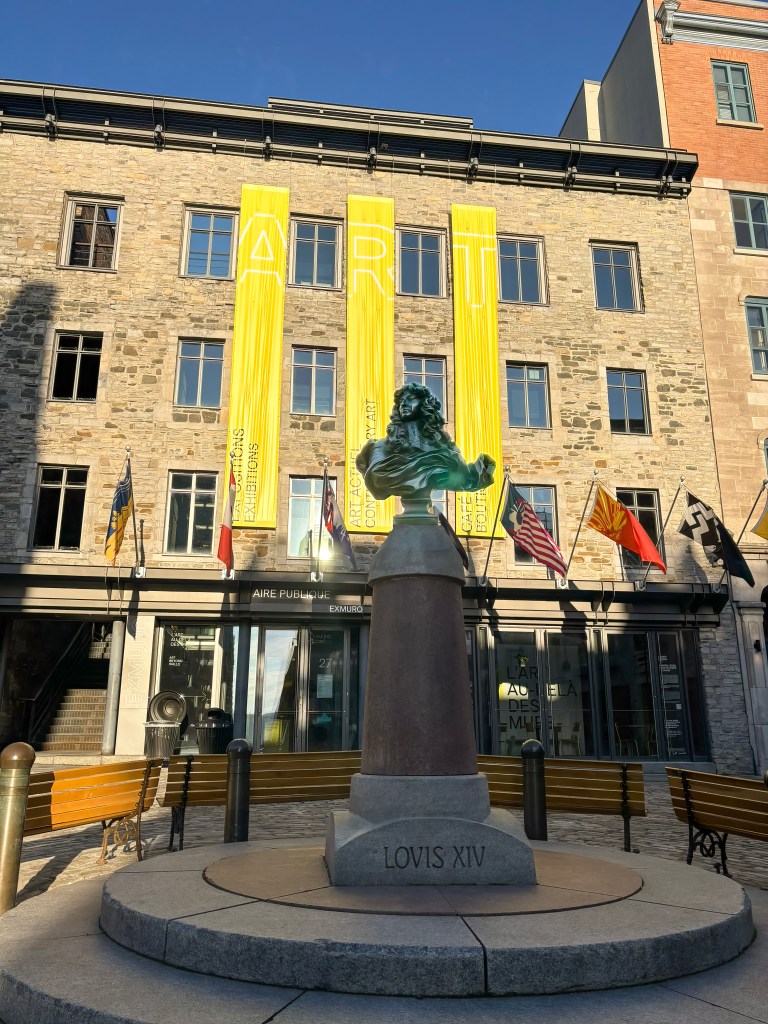
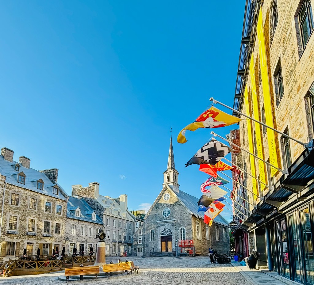
A short walk from Petit-Champlain brings you to Place-Royale, the small cobblestone square many consider the birthplace of French civilization in North America. This is the exact spot where Samuel de Champlain built his second habitation in the 1620s, and for well over a century the square functioned as the colony’s central marketplace — known simply as Place du Marché until a bust of Louis XIV was installed in 1686, giving the square its royal name.
The square fell into decline after Québec’s trade shifted toward Montréal in the 19th century, but a major restoration effort beginning in the 1970s returned it to its French colonial character. Today, Place-Royale is ringed with beautifully preserved 17th- and 18th-century buildings, many now home to cafés and boutiques. At its edge sits Notre-Dame-des-Victoires, built starting in 1688 and considered the oldest stone church in North America. Look down near the church, and you can still see the outline marking where Champlain’s original habitation once stood.
Fresque des Québécois (Mural of Quebecers)
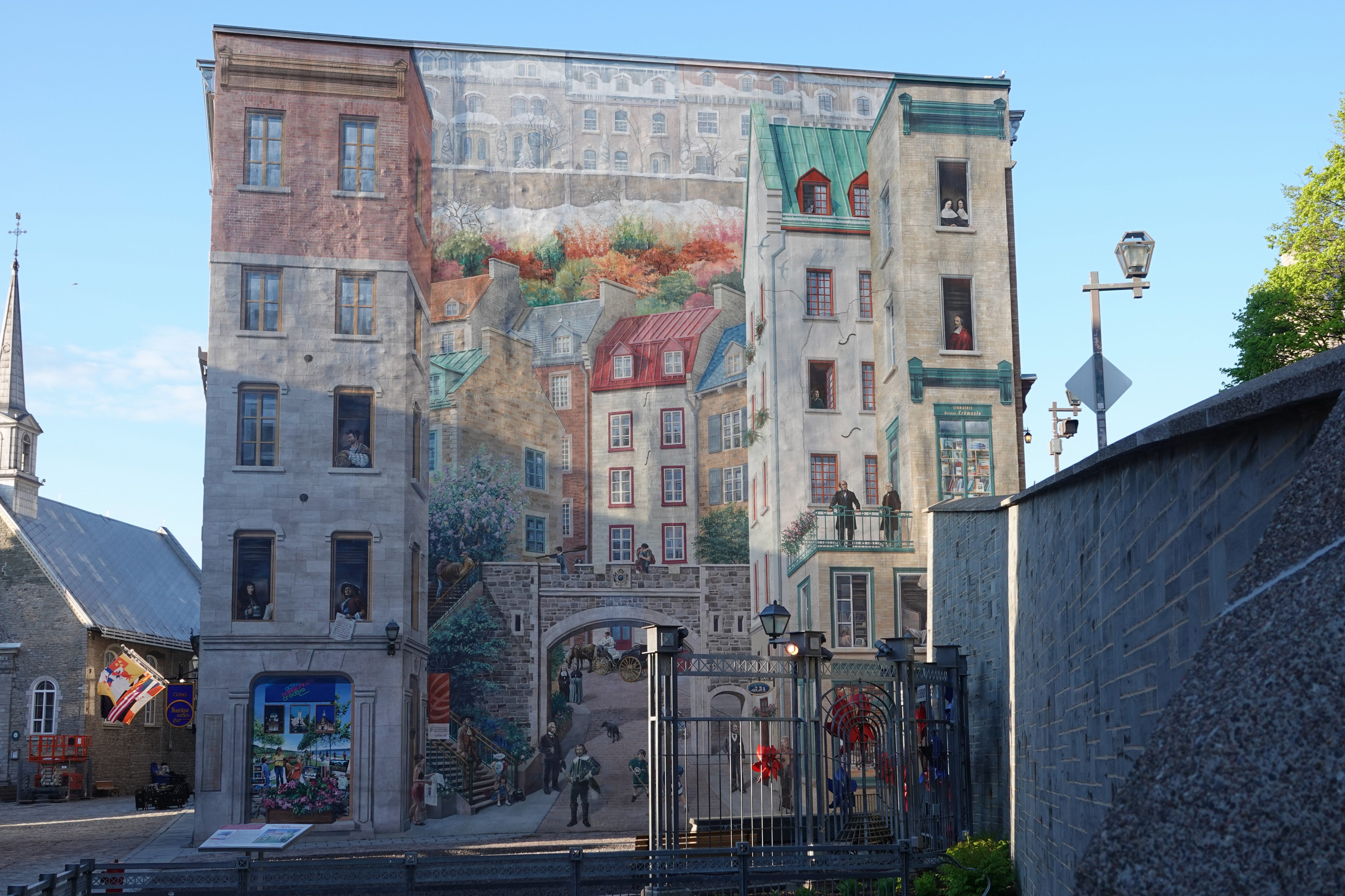
Just beside Place-Royale, on the wall of the Maison Soumande on rue Notre-Dame at the foot of Côte de la Montagne, you’ll find one of the most striking pieces of public art in the city. Painted in 1999 by a team of twelve French and Québécois artists over just nine weeks, this massive trompe-l’œil fresco creates the illusion of real architecture, balconies, and windows — and populates them with the faces that shaped Québec’s history.
The mural groups its figures thematically. There are the explorers and founders: Jacques Cartier and Samuel de Champlain, who charted the northeastern coast of the continent and planted the first colonies, alongside Louis Jolliet, the Québec City–born cartographer who mapped the Mississippi River. Nearby stand the builders and defenders of New France — intendant Jean Talon, who grew the colony’s population and economy, and Governor Frontenac, whose name graces the hotel where this walk began, and who organized the city’s defenses — as well as later reformers Louis-Joseph Papineau and Thaïs Lacoste-Frémont.
Another cluster honors those who devoted their lives to education and charity: Bishop François de Laval and Ursuline co-founder Marie Guyart (alongside Catherine de Longpré, who cared for the sick), plus Marie Fitzbach and Marcelle Mallet, who each founded religious orders dedicated to helping the poor. Financial pioneer Alphonse Desjardins, founder of the credit union that still bears his name, appears here too. Rounding out the fresco are the cultural icons who helped forge a national identity: historian François-Xavier Garneau, beloved singer-songwriter Félix Leclerc, and Lord Dufferin himself — the governor general who extended the terrace you stood on at the start of this walk.
The Fresque des Québécois is just one entry in a wider series of murals scattered across the city center, but its scale and detail make it a standard stop on any walking tour of Old Québec.
Back Up via Rue Saint-Louis
To close the loop, climb back up toward Upper Town — either retracing your steps to the funicular or following Côte de la Montagne — and pick up Rue Saint-Louis, one of Old Québec’s oldest and most storied streets, which leads directly back toward your starting point at Château Frontenac. Unlike many of the city’s steep, stepped streets, this one runs comfortably flat, making it an easy stroll past stone townhouses, ironwork balconies, and steep dormered rooflines typical of traditional Québécois architecture.
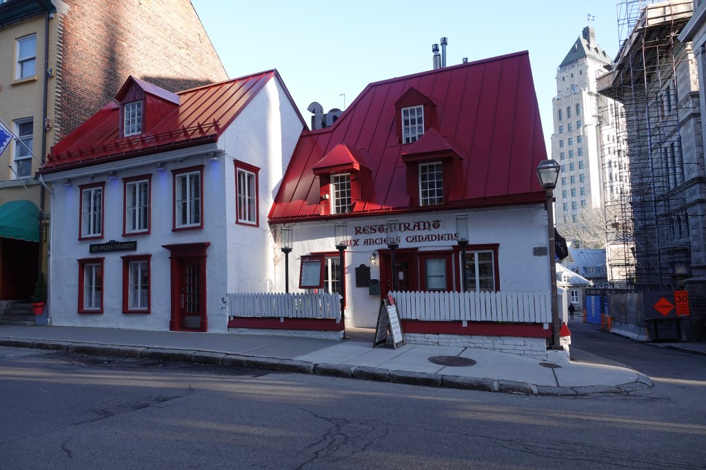
Along the way, keep an eye out for Maison Jacquet, built in 1674 and often cited as the oldest house in Québec City — its distinctive white walls and bright red roof now house the restaurant Aux Anciens Canadiens. Nearby, the 1736 Maison Maillou and the 1830s Maison Kent add further layers of history to the street.
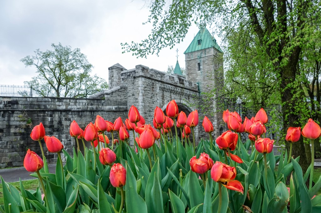
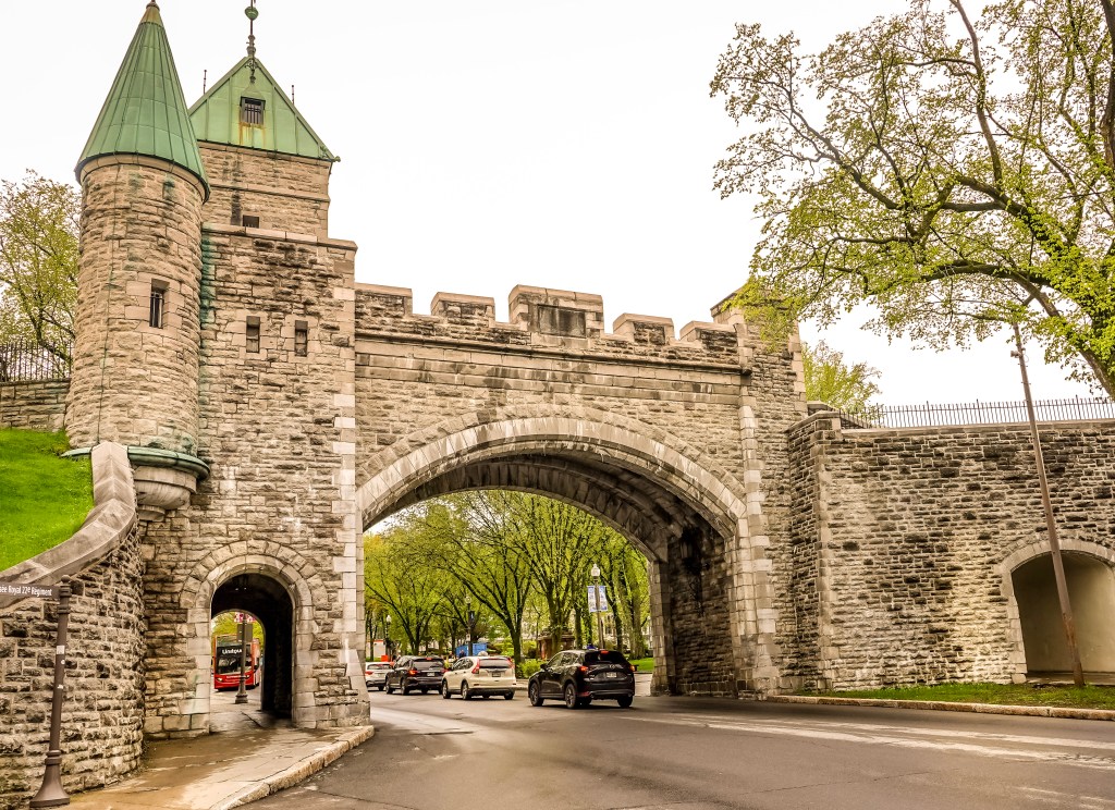
If you have energy left, continue past Place d’Armes to the Saint-Louis Gate, one of the last surviving gates in the city’s fortification walls, and climb its stairs for a panoramic view back over the street and toward the Parliament Building beyond.
From here, the walls open onto Grande Allée and the boulevard beyond, where the loop keeps going rather than turning back — straight toward the green copper roof of the Parliament Building.
We decide to do the Parliament Building, plans of Abraham the next day, and just started again from Château Frontenac and walked through Rue Saint-Louis
The Parliament Building
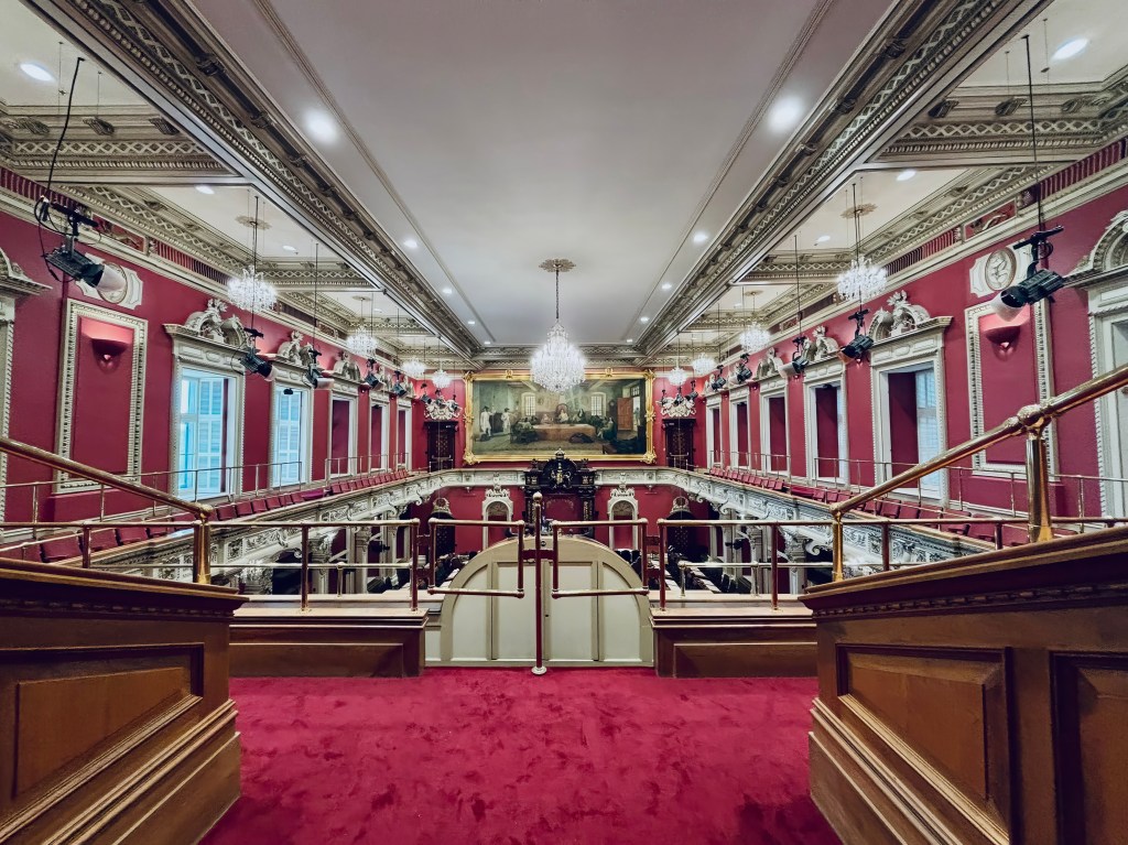
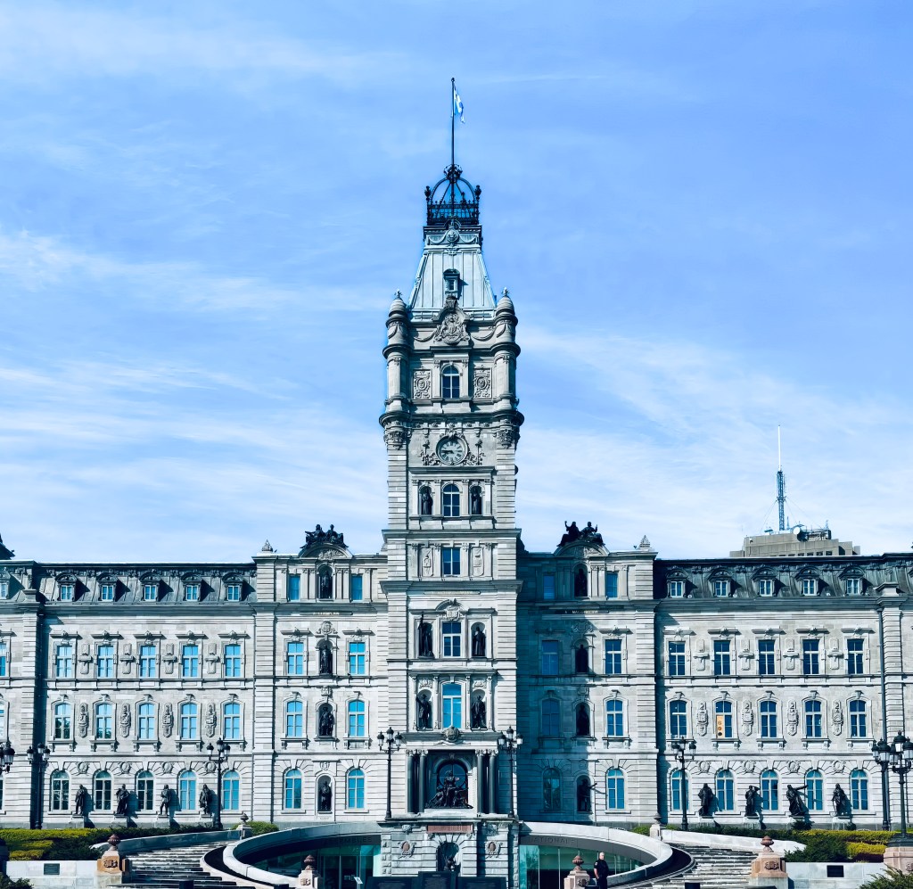
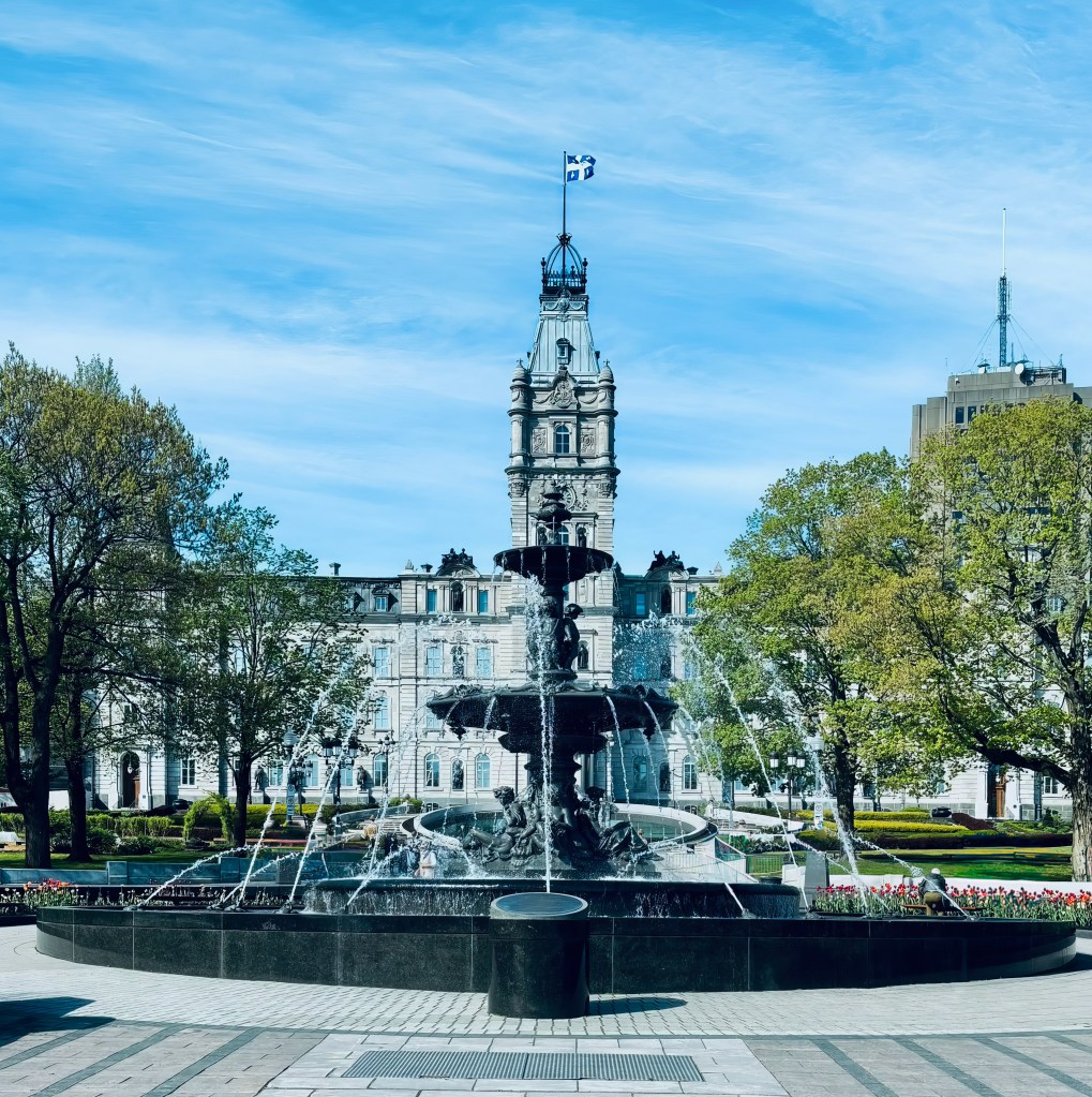
Just outside the old fortified walls, on what’s known as Parliament Hill, stands the seat of Québec’s National Assembly. Designed by architect Eugène-Étienne Taché and completed in 1886, the building is done in an ornate Second Empire style with a French Renaissance flavor, and its façade is lined with dozens of bronze statues honoring figures from Québec’s history — a smaller, sculpted echo of the Fresque des Québécois you passed earlier in Lower Town.
Out front, the Fontaine de Tourny sparkles amid manicured gardens, making the grounds a pleasant stop even if you don’t go inside. Free guided tours run on the hour and cover the building’s political history and architecture in about an hour; reserving online in advance and arriving early for security is worth doing in high season. Ask about the library on your way out — self-guided visits there tend to reveal more than the tour itself.
Plains of Abraham
From Parliament Hill, it’s a short walk to the Plains of Abraham, the sprawling green space where, in 1759, British and French forces fought the battle that decided the fate of New France and helped shape the future of Canada. Little of that history is visible on the surface today; instead, you’ll find rolling lawns, mature trees, and some of the best skyline and river views in the city.
The park is open around the clock and free to wander, with walking trails, picnic tables, a small theater, and a café tucked into the grounds. History buffs can detour into the Plains of Abraham Museum for more context on the battle, while everyone else can simply enjoy the open space — a favorite of locals for jogging, picnicking, and, each summer, major outdoor festivals. Budget some time here; the park is large, and the walk between its edges is longer than it looks on a map.
The Citadelle
Continuing along the cliff’s edge from the Plains, the star-shaped Citadelle of Québec comes into view atop Cap Diamant. Built by the British starting in the 1820s to defend against a feared American invasion that never came, it’s the largest fortified group of buildings in North America still occupied by troops, currently home to the Royal 22e Régiment of the Canadian Army.
Entry is by guided tour only, departing on the hour, and it’s worth timing a visit around the daily cannon firing or, in summer, the changing of the guard ceremony. The tour winds through ramparts and powder magazines with sweeping views over the St. Lawrence, and a museum inside houses military artifacts and regimental history — allow extra time to explore it after the guided portion ends. I took some of my photographs of the trip from the citadelle
Back Down to Château Frontenac
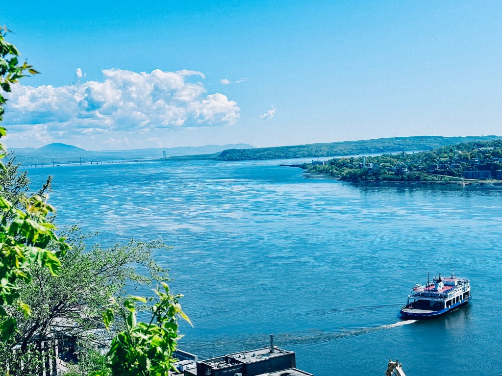
To close the loop, follow the fortification walls back toward the old city. The most scenic option is to pick up the Governors’ Promenade, the cliffside boardwalk that hugs the cliff face below the Citadelle and links back to Dufferin Terrace — the same terrace where this walk began. It’s a fitting final stretch: the same river views that opened the walk accompany you back to the Château.
Bringing It All Together
This loop — Château Frontenac and Dufferin Terrace, down to Petit-Champlain, across to Place-Royale, past the Fresque des Québécois, back up Rue Saint-Louis, out to the Parliament, across the Plains of Abraham, into the Citadelle, and home again along the Governors’ Promenade — covers roughly four centuries of Québec’s history, both inside and outside its walls, in a single walkable day. You’ll end up exactly where you started, having traced the same ground as governors, fur traders, bishops, soldiers, and songwriters, all within and around one of North America’s few remaining fortified cities.
Planning your own walk through Old Québec? Lace up comfortable shoes — much of this route involves cobblestones, stairs, and slopes, and the full loop with the Parliament, Plains, and Citadelle added is a full day’s outing — and budget extra time for the inevitable stops for photos, pastries, and window-shopping along the way.

 Peaks to Palaces